
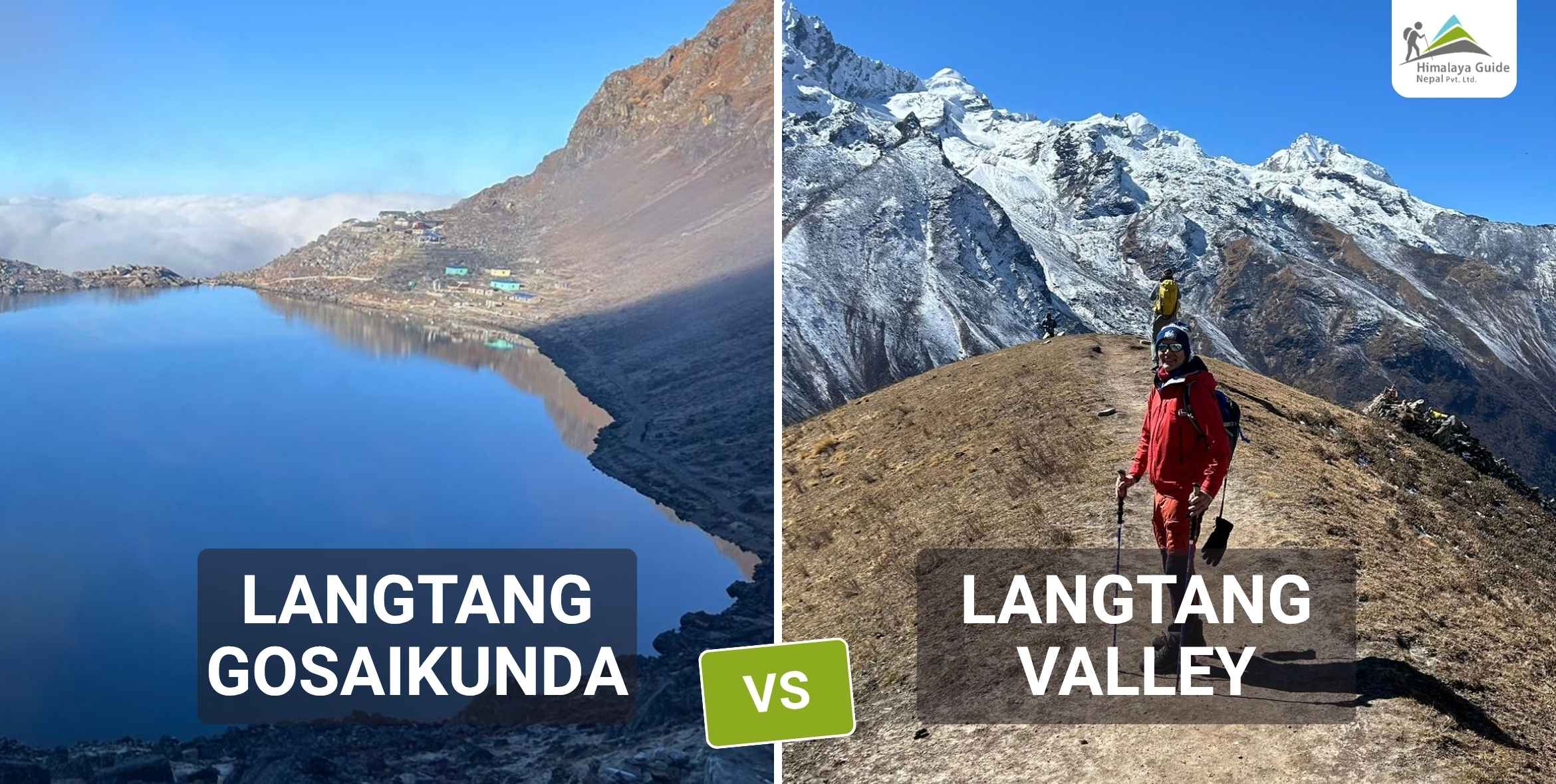
Both Langtang Gosainkunda & Langtang Valley leave from Syabrubesi. Langtang Valley Trek takes 7 to 10 days, stays mostly below 4,000m, and suits first-timers. Langtang Gosaikunda Trek needs 10 to 14 days, pushes you above 4,600m, and ends at a sacred high-altitude lake most foreign trekkers never reach. Your dates and how your body handles altitude are what decide it.
Not better or worse. Easier or harder, shorter or longer, familiar or remote. Both routes start on the same bus out of Kathmandu. Both pass through the same forest on day one. The choice only becomes visible four days in, standing at Kyanjin Gompa, when one group packs up and goes home and another group keeps walking north to gosaikunda trek.
Talk to our team at Himalaya Guide Nepal we’ll build your itinerary in one call.
What Is the Langtang Valley Trek?
The Langtang Valley Trek is the route most people mean when they say “Langtang.” Seven to ten days. You get off the jeep in Syabrubesi at 1,460m, walk into a forest that swallows the mountains completely on day one, and by day four you’re sitting in Kyanjin Gompa at 3,870m eating fresh yak cheese with Langtang Lirung right there in front of you. Not in the distance. Right there.
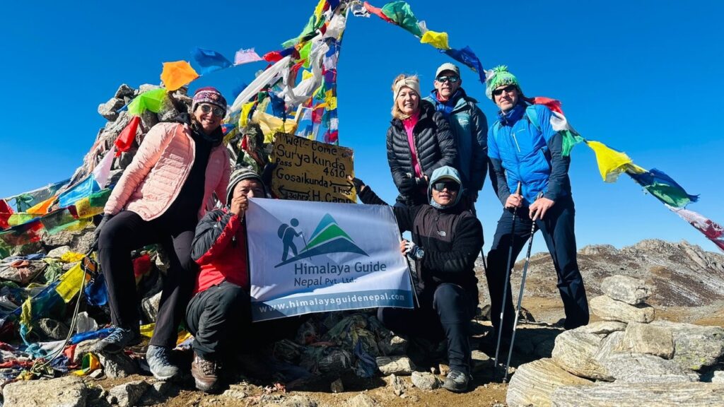
Syabrubesi to Lama Hotel is day one long, forested, no altitude gain worth worrying about. Then the trail climbs through Ghodatabela and Langtang Village to Kyanjin Gompa. From Kyanjin you can do an optional day hike to Kyanjin Ri at 4,773m or go harder to Tserko Ri at 5,033m. Neither summit is technical. Both will test your lungs if you haven’t acclimatized properly.
What the Langtang Valley Trek Actually Feels Like
Pine resin, first two days. The trail runs close to the Langtang Khola and the river sounds carry through the trees before you see the water. Then from lama hotel yaks start crossing the trail. The villages along the lower section have prayer flags on every building and that particular kind of quiet you only get at altitude, in the early morning, before the other trekkers start moving.
Kyanjin Gompa stops most people. A monastery from the 14th century, a cheese factory the same family has been running for decades, and a wall of Himalayan peaks so close they look incorrect. One rest day there doing nothing useful is not wasted. It’s the point to see the view of mountains in 180 degree.
Where Langtang Valley Trek Is Actually Hard?
The climb from Lama Hotel to Kyanjin is long and doesn’t flatten much. Most people feel it in their legs. The altitude between Langtang Village at 3,430m and Kyanjin Gompa at 3,870m is manageable in one push, but trekkers who arrive at Kyanjin and immediately book Tserko Ri for the next morning are the ones who end up lying down in the afternoon with a headache.
Cold is more serious than most Langtang trip. October nights at Kyanjin drop well below zero. A sleeping bag rated -10°C is the required.
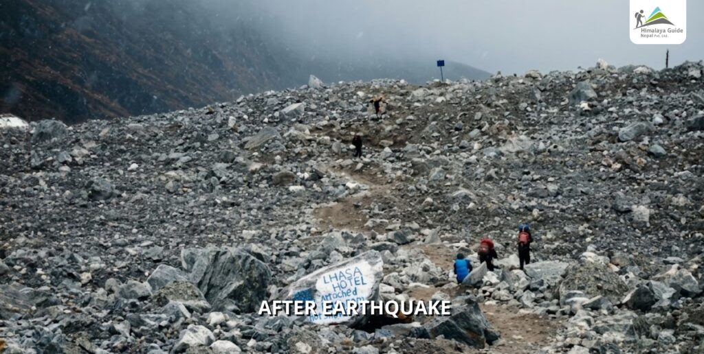
One thing worth knowing before you go was the Langtang Village was nearly wiped out in the 2015 earthquake. It was rebuilt by the same community that lost it. The rebuilt version looks different from old photos. We have also attached the photo of Langtang Valley Before & After Earthquake here.
What Is the Langtang Gosaikunda Trek?
The Langtang Gosaikunda Trek begins identically to the langtangvalley route. Same bus, same first three days of walking, same arrival at Kyanjin Gompa. Then instead of turning south to go home, you loop north and west, gain altitude above the treeline, cross Laurebina Pass at 4,610m, and come down to Gosaikunda Lake at 4,380m.

It takes 10 to 14 days total. The section above 4,000m is exposed in a way the valley never is more wind, less shelter, colder nights, fewer teahouses and smaller ones when you find them. You carry more layers than you think you need. You drink more water than feels necessary.
The exit is one of the better parts. You can descend back to Dhunche and catch the same road home, or walk out through Sundarijal, which drops you about an hour by taxi from central Kathmandu. The Sundarijal exit makes the whole thing feel like a proper one-way journey. Psychologically, that matters more than it sounds.
See the full difficulty breakdown for Langtang Gosaikunda Trek before you commit if altitude is something you’re uncertain about.
What Gosaikunda Actually Looks Like
Nobody describes Gosaikunda Lake well. It’s not that they’re exaggerating it’s that the combination of altitude, cold, silence, and stillness doesn’t compress into sentences easily.
The lake sits at 4,380m in a glacial bowl. Water doesn’t move in the morning. There are no vendors at the edge, no teahouses with chalk menus, no Wi-Fi password signs. Hindus believe Lord Shiva created the lake. Thousands of pilgrims walk to it every August for Janai Purnima to bathe in the water, and the trail during that festival looks completely different from what you see in October. Outside festival season, you pass maybe a handful of trekkers a day.
Our guides cross Laurebina Pass regularly. They still stop at the lake. Always. That’s not a performance for clients it just happens.
Above the lake the ridge opens wide. On a clear morning you see the Annapurna range to the west and the Langtang massif to the north from the same spot. The wind on that ridge is real. Dress like it will get worse.
Where Gosaikunda Gets Difficult?
Altitude is the central risk, and it’s not subtle. Moving from Kyanjin at 3,870m to the lake at 4,380m to Laurebina Pass at 4,610m in two or three days is aggressive even by Himalayan trekking standards. Most of the problems we’ve seen on this route people turning back, needing descent trace to one of two things: a skipped acclimatization day, or a group that pushed the pass crossing in deteriorating weather.
The pass trail is loose and rocky in sections. Not technical, but slow when your legs are already working hard and the oxygen isn’t cooperating.
Below the pass, the Sundarijal descent is very long. Pushing to the road in one day means 10 to 12 hours of walking. Most itineraries split it into two days. That’s the right call.
Check the best time to trek Langtang Gosaikunda before choosing dates especially the pass section, which has its own weather window.
Langtang Valley Trek vs Langtang Gosaikunda Trek Difference
| Langtang Valley Trek | Langtang Gosaikunda Trek | |
|---|---|---|
| Duration | 7–10 days | 10–14 days |
| Highest Point | 5,033m (Tserko Ri, optional) | 4,610m (Laurebina Pass) |
| Days Above 4,000m | 1–2 optional day hikes | 4–5 days in a row |
| Difficulty | Moderate | Moderate to Hard |
| Teahouses | Comfortable throughout | Gets sparse above 4,000m |
| Crowds | Moderate | Low |
| Exit Point | Back to Syabrubesi | Dhunche or Sundarijal |
| Route Shape | Out and back | Loop / point-to-point |
| Best For | First-timers, families | Prior altitude experience needed |
The one column that matters most: days above 4,000m. One or two optional day hikes versus four or five consecutive days. That difference is physical, not logistical.
Which Trek is Better for You?
Here’s the honest version: if you have 10 days or fewer, you’re doing the valley route. That’s not a downgrade. The valley is the reason Langtang has the reputation it has.
If you have 12 to 14 days and you’ve been above 3,500m before without problems, Gosaikunda is worth choosing.
Take the Langtang Valley Trek If…
This is your first time trekking above 3,000m in the Himalayas. Or you’re with a group that has mixed fitness levels. Or you have a hard departure date and can’t afford a safety buffer for altitude delays.
The valley route gives you everything Langtang is known for the Tamang villages, the Himalayan wall at Kyanjin, the glaciers, the cheese factory, the optional high-altitude day hikes for stronger members of the group and it keeps sustained altitude to one or two days rather than four or five.
Families and mixed groups do this route well. The trail is busy enough that you’re not isolated if something goes wrong, and slower hikers can rest at Kyanjin while faster ones push the ridge.
Take the Langtang Gosaikunda Trek If…
You’ve trekked at altitude before Annapurna Base Camp, Island Peak base, anything that put you above 3,500m for multiple nights. You know your body doesn’t panic above 4,000m. You want the lake. You want the pass. You want to come out at a different trailhead than the one you started at.
The Sundarijal exit is underrated as a reason to choose this route. Walking out of the mountains in a different direction than you came in changes something about how the trip sits in memory. It feels complete in a way an out-and-back doesn’t.
Read through the Langtang region attractions to see the full picture of what you’d be adding.
When to Go for Langtang Region Treks
October and November are favorable for Langtang Valley and also Gosaikunda Trek. The monsoon clears by late September and the skies hold through most of November. Trails are dry, visibility is good, and the mountain views are as clear as they ever get. This is not complicated advice October and November are when Langtang is at its best.
Spring is second bes time for these treks. March to May. Rhododendrons bloom below 3,500m from late March and the lower forest smells different from autumn wetter, denser. Mornings on trail are usually clear. Afternoons cloud over.
For the Gosaikunda route specifically, avoid December through February if you’re planning to cross Laurebina Pass. The pass accumulates serious snow not cosmetic snow, but chest-deep snow that has turned groups back in January. Most teahouses above Gosaikunda close completely in winter. There’s no version of this crossing that’s worth attempting in those months.
Monsoon from June through August is difficult in the valley and dangerous above 4,000m. Leeches from Syabrubesi up to around 2,500m, wet rock, persistent cloud cover, and visibility that can close in for days. August is the one exception the Janai Purnima festival in August brings thousands of Hindu pilgrims to Gosaikunda, and if you want to understand what this lake means outside the context of trekking tourism, that’s the only time to see it.
Permits for Langtang Valley vs Gosaikunda Trek
Same permits for both routes:
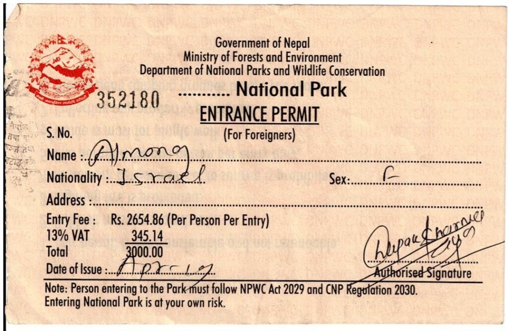
- Langtang National Park Entry Permit: NPR 3,000 per person
- TIMS Card: NPR 2,000 per person in a group, NPR 4,000 solo
Pick both up in Kathmandu before leaving. Our team handles this for all clients no queues, no wrong counters, done the day before departure. Full information on the permit page for Langtang Gosaikunda Trek.
Getting to the trailhead: the Kathmandu to Syabrubesi drive takes 7 to 8 hours by local bus or 5 to 6 by private jeep. Take the jeep. The road is rough and the local bus on that route on a full day is genuinely unpleasant. Arrive with energy rather than without it.
If you exit at Sundarijal on the Gosaikunda route, a taxi back to Kathmandu is about one hour and costs NPR 1,000 to 1,500 arguably the fastest return from any major trekking region in Nepal.
Full cost langtang gosaikunda trek breakdown with guide fees, porter rates, food costs on trail.
How We Operate Both Langtang & Gosaikunda Trek
Our Langtang guides are from the valley. Not Kathmandu-office staff who memorized a route description people who grew up there, whose families run teahouses there, who have walked both routes in every season including the ones when you shouldn’t.
They know things that don’t appear in any guidebook. Which teahouse kitchen is clean. Which section of the trail below Kyanjin turns into a stream after overnight rain. What a trekker looks like two hours before altitude sickness becomes a real problem rather than a headache they’ll sleep off.
We’ve sent groups home early. We’ve also had clients push Tserko Ri on day six after we told them to rest, feel fine in the moment, and call us the next morning unable to move. The acclimatization schedule we build isn’t conservative for its own sake it’s based on what we’ve actually seen happen on these trails.
Private and small group options are both available. Extra acclimatization days, route adjustments, Tserko Ri additions before the Gosaikunda crossing all of it gets built into the plan before you leave Kathmandu, not decided on the fly.
Book your Langtang treks or message the team to talk through the route first.
FAQ about Langtang Valley vs Gosaikunda Trek
Can I combine both routes into one trek?
Is Gosaikunda safe for someone with no altitude experience?
How long is the drive from Kathmandu to the trailhead?
Do regulations require a guide for these treks?
Spring or autumn for the Gosaikunda crossing?
Langtang Valley vs Gosaikunda Trek Conclusion?
Langtang Valley is the Langtang most people know: river valleys, Tamang villages, yak pastures, and one of the closest views of an 8,000m-class peak you’ll get in Nepal without a technical permit. It’s a complete trek on its own terms.
Gosaikunda adds a different kind of day. Altitude above the treeline, a ridge crossing with weather that can change in an hour, and a lake that’s been sacred far longer than this trail has existed.
Neither route is the consolation version of the other. They’re built for different trips and different people. You know your time. You know your body. Pick the route that fits and we sort the rest.
Contact Himalaya Guide Nepal and book your Langtang trek today.


