The Gen Z movement, Nepal stabilized, and life returned to normal. All safe for your Travel in Nepal 2025.
Kanchenjunga Base Camp Trek
Country
Nepal
Difficulty
Challenging
Best Season
Mar-May/Sept-Nov
Accommodation
Lodge/Tea House
Region
Restricted Area Trekking
Start / End Point
Kathmandu/Kathmandu
Max. Altitude
5,143 m (Kanchenjunga North Base Camp or Pangpema )
Meals Included
Breakfast, Lunch, Dinner
Acclimatization
Ghunsa
Permits
Kanchenjunga Restricted Area Permit (RAP) and Kanchenjunga Conservation Area Permit (KCAP)
Duration
20 Days
Activity
Less Touristy Trekking
Distance
Kanchenjunga Base Camp Trek Overview
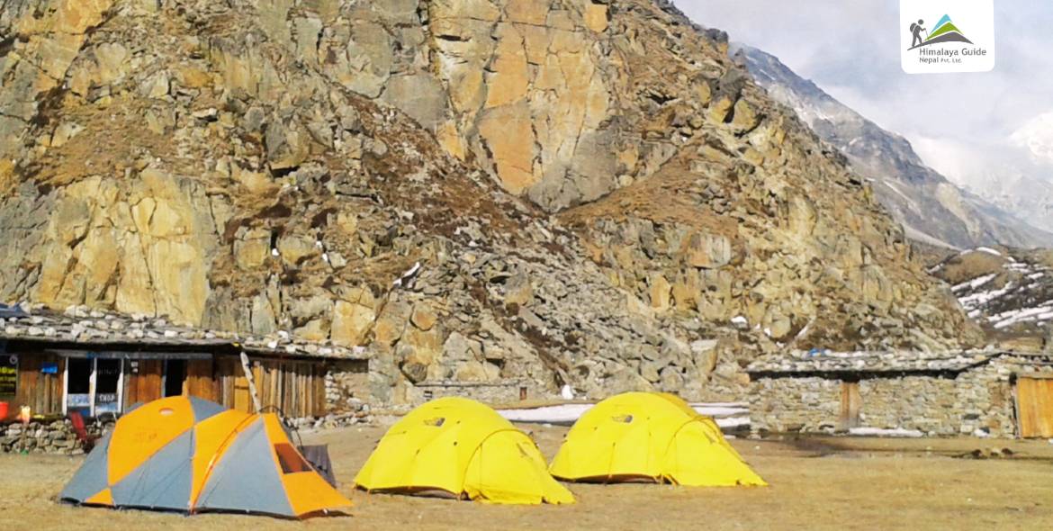
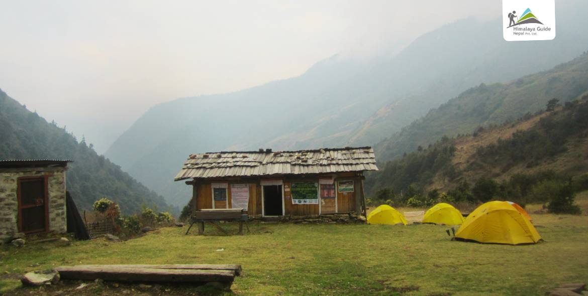
Kanchenjunga Base Camp Trek is a less touristy trekking area in the eastern region of Nepal. Mt. Kanchenjunga is the third highest mountain in the world. Kanchenjunga base camp trek follhttps://himalayaguidenepal.com/less-touristy-trekking/ows the Tamor river bank and valley, approaching the mountain base camp. Once mainly a camping trek, now the trek offers a simple teahouse trekking experience with basic lodges and local meals along the trail.
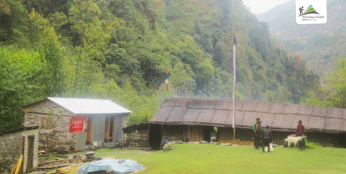
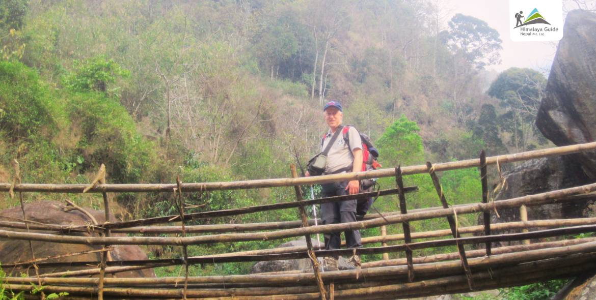
Kanchenjunga Base Camp trek route passes some of the country’s richest and most pristine forests, and a restricted area trekking Nepal to the lap of Mt. Kanchenjunga. There are very normal lodges and food available along the trek. In Kanchenjunga Base Camp, most groups fly into Bhadrapur and drive to Taplejung. The trekking start point and ending point of the trek is Taplejung district of Eastern Nepal. You could also walk to Taplejung from Basantapur, which takes about three days longer.
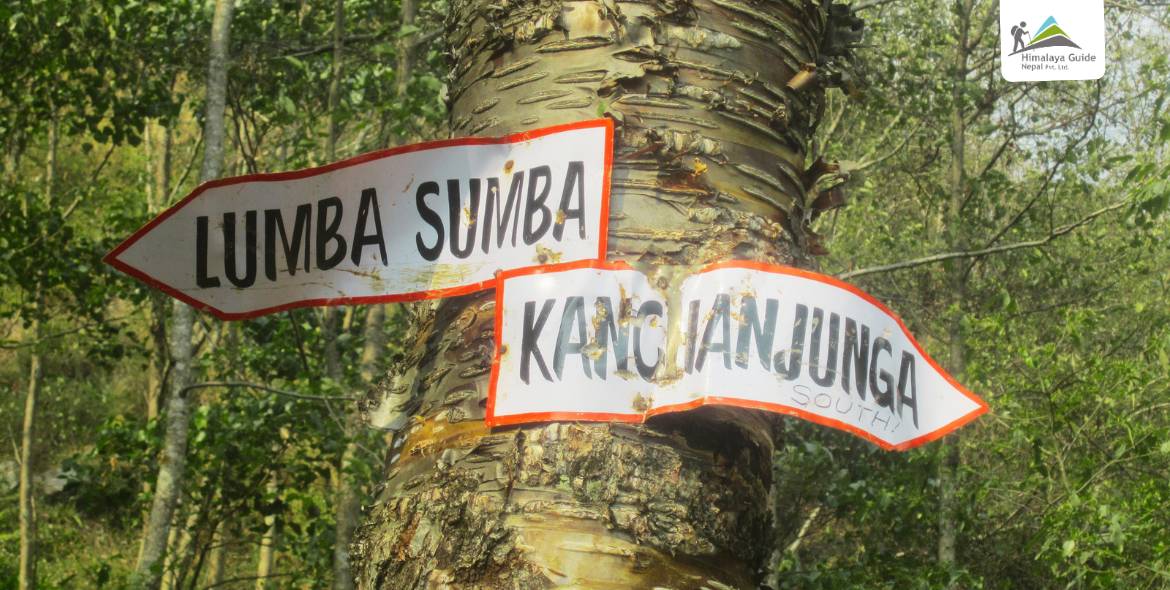
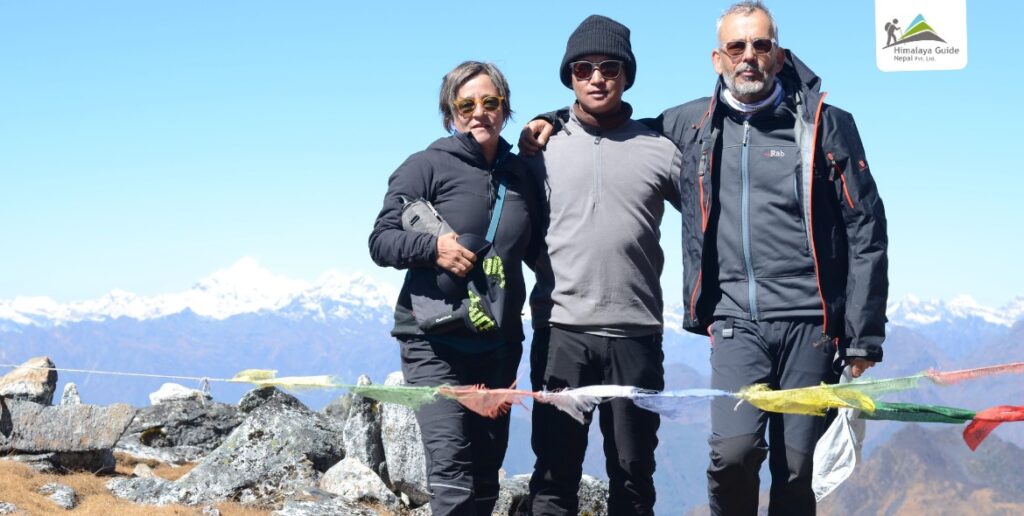
Two separate routes head northeastward from Taplejung, one to the north base camp and the other towards the Kanchenjunga south base camp. These routes can be combined into a circuit. The north base camp trek reaches a higher altitude and offers closer views of Kanchenjunga’s glaciers.
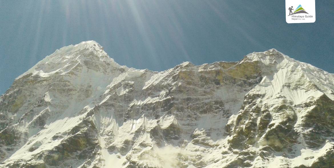
Kanchenjunga Trek is one of the less crowded areas in the country with a spectacular landscape; Himalaya peaks rising above 7,000 m, lush flora and fauna, and Mt. Kanchenjunga 8,586 m. It is on the far eastern Nepal border with India’s Sikkim in the east and the Tibet Autonomous Region of China in the north. Kanchenjunga tea house trek is ideal for those seeking fewer tourists and a peaceful walk.
What to Expect from Kanchenjunga Base Camp Trek?
- Walk through the remote corners of Mt. Kanchenjunga, the world’s third-highest mountain at 8,586 m.
- Experience Nepal as it was decades ago, pure, wild, and untouched by modern tourism
- Spot rare plants and animals like red pandas and snow leopards when walking through the Kanchenjunga Conservation Area.
- Enjoy peaceful trails with fewer trekkers, lush forests, rivers, waterfalls, and open meadows.
- Cross several suspension bridges and high mountain passes.
- Reach the North Base Camp of Mt. Kanchenjunga, which offers stunning views of Tent Peak, Chang Himal, Jannu, and other Himalayan peaks, including Kanchenjunga.
- Stay in basic tea houses, no luxury lodges or WiFi, just genuine mountain hospitality.
- Meet friendly locals from the Sherpa, Limbu, Rai, and Gurung communities.
- Explore Tibetan Buddhist culture and visit ancient monasteries along the trail.
What Does A Trekking Day Look Like?
A trekking day during the Kanchenjunga Base Camp trek looks like this:
- 6:00 AM: Wake up early to the fresh mountain air and sounds of nature.
- 6:30 AM: Get ready for the day, wash up, and prepare your gear for the trek.
- 7:00 AM: Enjoy a hearty breakfast at your lodge or teahouse to fuel your trek.
- 8:00 AM: Start walking along the Kanchenjunga Base Camp trail, surrounded by forests, rivers, and mountain views.
- 10:30 AM: Take a short break, have water or tea.
- 12:30 PM: Stop for lunch at a teahouse or a scenic spot along the Kanchenjunga Base Camp trek path.
- 1:30 PM: Resume trekking, passing through small villages, streams, and alpine meadows while observing local life.
- 4:30 PM: Arrive at your lodge for the day, rest, and enjoy the views.
- 5:30 PM: Take some time to relax, maybe explore the nearby area, or chat with fellow trekkers.
- 6:00 PM: Have dinner and enjoy the evening in the peaceful mountains.
- 8:00 PM: Go to bed early to recharge for the next day on the Kanchenjunga Base Camp trail.
Every day on the Kanchenjunga Base Camp trek is different. Some days are shorter and easier, while others can be pretty long, around 7 or 8 Hours. Out of 20 days, you will be trekking or walking for 14 days. 2 days are spent flying and driving, and the other 2 days are long drives through beautiful landscapes.
Outline Itinerary For 20 Days Kanchenjunga Base Camp Trek
| Route | End Elevation | Elevation Gain/Loss | Duration | Distance |
|---|---|---|---|---|
| Day 1 Arrive TIA → Thamel (drive) | 1,350 m | 0 | 25 min drive | 5KM drive |
| Day 2 Fly KTM → Bhadrapur, drive → Ilam | 3,660 m | ↑ 2,360 m | 45 min flight + 4-5 Hours drive | 66KM drive |
| Day 3 Ilam → Panchthar → Taplejung | 1,820 m | ↓ 1,840 m | 6-7 Hours drive | 120–150KM drive |
| Day 4 Taplejung – Hangdewa – Mitlung | 921 m | ↓ 899 m | 5-6 Hours trek | 9–10KM |
| Day 5 Mitlung – Sinwa – Tawa – Thiwa – Chirwa | 1,270 m | ↑ 349 m | 5-6 Hours trek | 13KM |
| Day 6 Chirwa – Tapethok – Phembu – Sukathum/Japantar | 1,576 m | ↑ 306 m | 6-7 Hours trek | 12KM |
| Day 7 Sukathum – Lamatar – Amjilosa | 2,308 m | ↑ 732 m | 4-6 Hours trek | 12KM |
| Day 8 Amjilosa – Thyangham – Gyapla | 2,730 m | ↑ 422 m | 5-6 Hours trek | 9KM |
| Day 9 Gyapla – Phale – Ghunsa | 3,590 m | ↑ 860 m | 5-7 Hours trek | 12KM |
| Day 10 Acclimatization in Ghunsa (side hikes) | 3,590 m | - | 3-4 Hours hike | 4KM (side hike) |
| Day 11 Ghunsa – Rampuk Kharka – Kambachen | 4,050 m | ↑ 460 m | 4-5 Hours trek | 10KM |
| Day 12 Kambachen – Ramtang – Lhonak | 4,780 m | ↑ 730 m | 5-6 Hours trek | 10KM |
| Day 13 Lhonak – Pangpema – back to Lhonak | 4,780 m | ↑↓ 363 m | 7-8 Hours trek | 15-16KM |
| Day 14 Lhonak – Kambachen – Ghunsa | 3,590 m | ↓ 1,190 m | 6-7 Hours trek | 14-16KM |
| Day 15 Ghunsa – Phale – Gyapla – Amjilosa | 2,308 m | ↓ 1,282 m | 7-8 Hours trek | 13KM |
| Day 16 Amjilosa – Sukathum – Phembu – Tapethok | 1,380 m | ↓ 928 m | 5-6 Hours trek | 9KM |
| Day 17 Tapethok – Chirwa – Thewa – Lingkhim | 1,850 m | ↑ 470 m | 3-4 Hours trek | 8-10KM |
| Day 18 Lingkhim – drive → Taplejung | 1,800 m | ↓ 50 m | 4–5 Hours drive | 40KM drive |
| Day 19 Taplejung – drive → Birtamod, Jhapa | 300 m | ↓ 1,500 m | 9-10 Hours drive | 200KM |
| Day 20 m Drive Birtamod → Bhadrapur – fly → Kathmandu | 1,350 | ↑ 1,050 m | 30 min drive + 45 min flight | - |
20 Days Kanchenjunga Base Camp Trek Itinerary
Arrival in International Airport, Nepal
Drive Distance
5KM
Drive Duration
25 min
Highest Altitude
N/A
Meals
Dinner
Accommodation
Hotel
- Starting Point: Tribhuvan International Airport, Kathmandu
- Ending Point: Thamel, Kathmandu
Once you land at Tribhuvan International Airport, a representative from Action Nepal Treks will be there to welcome you. Look out for a sign with your name. After a warm greeting, you will be transferred to your hotel in a private vehicle.
Check it at the hotel and take a rest. You can spend the rest of the day either resting at the hotel or taking a short walk around Thamel. Thamel is a lively tourist area in Kathmandu filled with shops, restaurants, and cafes. Overnight at the hotel in Kathmandu.
Kathmandu to Bhadrapur by flight, then drive to Ilam
Drive Distance
66KM
Drive Duration
4-5 Hours
Flight Hours
45 min
Highest Altitude
N/A
Meals
Breakfast, Lunch, Dinner
Accommodation
Lodge
- Starting Point: Kathmandu
- Ending Point: Ilam
On day 2, after breakfast, you will take a short 45-minute flight from Kathmandu to Bhadrapur (Chandragadi Airport), located in the southeastern plains of Nepal. From the airport, you will drive towards Jhapa on public transport, which will take 30 minutes. From Jhapa, you will again continue on a drive journey to reach Ilam, your destination for the day. It will take around 4-5 Hours.
Ilam is a beautiful hill town famous for its endless tea gardens and cool mountain climate. Along the way, you will pass lush green hills, rolling tea plantations, and charming villages that show what the rural lifestyle of eastern Nepal is like. Not to mention, the fresh air and peaceful surroundings make the drive enjoyable. After you reach Ilam, you will check into the lodge. Then, you can either take a short walk around the town or visit the Ilam tea gardens before settling in at the lodge hotel for the night.
About Illam and Tea Garden in Nepal:
Illam lies in the far eastern part of Nepal and is often known as the “Queen of Hills” due to its spectacular beauty. Its rolling green hills are covered with lush tea gardens. Likewise, the climate is cool and pleasant. All these factors have made Illam and its tea garden a popular destination for locals as well as international visitors. Far from the city’s hustle and bustle, you can also witness traditional houses and the heritage of the Rai and Limbu ethnic communities.
The tea produced from the Illam Tea Garden is popular worldwide. The locals here have cultivated the tea for over a century. Its distinct taste and rich aroma are quite similar to those of the Darjeeling tea plantation. Upon reaching Illam on your day 2 of the Kanchenjunga Base Camp Trek, you can visit this famous Tea Garden and stroll around. Similarly, you can watch the plucking of tea leaves and take a sip of the freshly brewed organic tea while enjoying the green hills’ views.
Ilam - Panchthar to Taplejung
Drive Distance
120-150KM
Drive Duration
6-7 Hours
Highest Altitude
N/A
Meals
Breakfast, Lunch, Dinner
Accommodation
Mountain Hotel
- Starting Point: Ilam
- Ending Point: Taplejung
Early in the morning, you can enjoy a beautiful sunrise over the tea gardens of Ilam, with the fresh air carrying the scent of green tea leaves. After breakfast, you will take a local vehicle and begin the journey toward Panchthar. At Panchthar, you can stop for a traditional Nepali Dal Bhat meal, often shared with pilgrims, locals from Taplejung, and trekkers heading to Kanchenjunga Base Camp.
After that, the drive continues along winding roads that pass through hillsides and cliffs. The route offers dramatic views of the surrounding landscape. Eventually, the road climbs to the hilltop town of Taplejung, where you will stay overnight at a lodge.
Taplejung - Hangdewa to Mitlung
Trek Distance
9-10KM
Trek Duration
5-6 Hours
Highest Altitude
921 m
Meals
Breakfast, Lunch, Dinner
Accommodation
Lodge
- Starting Point: Taplejung
- Ending Point: Mitlung
The fourth day of the Kanchenjunga Base Camp trek itinerary officially marks the beginning of your trekking journey. After breakfast in Taplejung, you will begin walking along the Kanchenjunga trekking trail and pass through peaceful villages, terraced farmlands, and friendly local communities. At first, the trail follows a gravel road out of Taplejung. Later, instead of continuing on the road, you will take a shortcut to Hangdewa by descending to the left.
From Hangdewa, the path follows the Hangdewa River. You will cross a suspension bridge here, enjoying views of the clear river water below. From the bridge, the North Kanchenjunga Base Camp route continues along the beautiful Tamor River trail. The path is flat with some gentle ups and downs. By late afternoon, you will reach Mitlung. Mitlung is a small riverside village on the Kanchenjunga Base Camp trekking route. Here, you’ll stay at a basic lodge that serves simple but hearty Nepali meals, perfect for ending your first day of trekking.
Mitlung - Sinwa - Tawa - Thiwa to Chirwa
Trek Distance
13KM
Trek Duration
5-6 Hours
Highest Altitude
1,270 m
Meals
Breakfast, Lunch, Dinner
Accommodation
Lodge
- Starting Point: Mitlung
- Ending Point: Chirwa
After breakfast in Mitlung, the trek continues along the right bank of the Tamor River. The trail starts with a roughly graded path to Sinwa. From Sinwa, the trek to Kanchenjunga Base Camp path ascends to Tawa in another 1.5 Hours. You may have to walk on debris from landslides before reaching Tawa. Tawa has a small tea shop, so you can stop here for lunch.
After lunch, the trail climbs before reaching Thiwa (a small hamlet with jeep access in some seasons). At Thiwa, jeeps to Taplejung are sometimes available. From Thiwa, the Kanchenjunga trekking route continues along the right bank of the Tamor Nadi to Chirwa. You will have to cross a wooden bridge to reach Chirwa. Chirwa is a lovely village where you will have a comfortable overnight stay.
Chirwa - Tapethoke - to Sukathum/Japantar
Trek Distance
~12 KM
Trek Duration
6-7 Hours
Highest Altitude
1,576 m
Meals
Breakfast, Lunch, Dinner
Accommodation
Lodge
- Starting Point: Chirwa
- Ending Point: Sukathum
Today’s trek from Chirwa to Sukathum (also known as Japantar) begins along the right bank of the Tamor Nadi. After about 1 hour and 30 minutes of pleasant walking on a trail similar to the previous day, you’ll reach Tapethok. Here, you’ll cross a suspension bridge over the Tamor River and continue along the left bank.
The Kanchenjunga Base Camp trek trail then climbs to Phembu (a small settlement and trail junction). At Phembu, you will stop for lunch. After lunch, you will continue walking, passing through small villages before reaching a trail junction – one leading to Gola and the Lumba Sumba Pass, the other toward the Kanchenjunga South Base Camp. You follow the right way. You will descend to the confluence of the Tamor Nadi and Ghunsa Khola. After crossing another suspension bridge over the Tamor River, the route follows the left bank of the Ghunsa Khola to reach Sukathum/Japantar. Overnight at Sukathum.
Sukathum - Lamatar to Amjilosa
Trek Distance
12KM
Trek Duration
4-6 Hours
Highest Altitude
2,308 m
Meals
Breakfast, Lunch, Dinner
Accommodation
Chhiringkipa Guest House
- Starting Point: Sukathum
- Ending Point: Amjilosa
The trail now follows the Ghunsa Khola, a river fed by glaciers from Kangchenjunga and Kumbhakarna (Jannu), which is a major tributary of the Tamor Nadi. When you reach this part of the Kanchenjunga Base Camp trek, the trek route can be a little tricky. First, you will turn right onto a rough path by the river. Walk for some minutes until you see a wooden bridge, but don’t cross it yet. Keep walking for another 10 minutes to find a metal suspension bridge, and cross it to the left side of the river. After 10 more minutes, cross back to the right side. After about an hour of walking, you will reach Lamatar (a rest stop before the climb to Amjilosa), where you will stop for lunch.
The trail goes over flat stones and past cliffs where you might see musk deer, which are common in this area. After about an hour, you will cross to the left side again. The next hour has some small hills with trails along the river and simple bridges. The last bridge of the day takes you back to the right side of the river. Then, there is a steep climb for about one hour, going up around 400 m over a few ridges before you reach Amjilosa. Here, you will stay overnight in a simple lodge on the Kanchenjunga Base Camp trek route.
Amjilosa - Thyangham to Gyapla
Trek Distance
9KM
Trek Duration
5-6 Hours
Highest Altitude
2,730 m
Meals
Breakfast, Lunch, Dinner
Accommodation
Namaste Guest House
- Starting Point: Amjilosa
- Ending Point: Gyapla
On the eighth day of the trek to Mount Kanchenjunga Base Camp, you’ll walk past many waterfalls along the way. The trail from Amjilosa to Gyapla first takes you into the jungle. Then, after 2.5 Hours, you’ll go down for about 30 minutes to reach Thyangham, where you will stop for lunch and rest. Along this part of the trek, you’ll see many waterfalls. Early on, the trail passes a big landslide area with some open rocky parts, then goes around a cliff before coming down past some rocky waterfalls.
After about an hour, you’ll cross a wooden suspension bridge near the third waterfall, and then another bridge 20 minutes later. Soon after, you’ll come to the fourth waterfall before a steep, wet, and slippery climb lasting about 30 minutes through a narrow gully. This climb takes you up to Gyapla. Gyapla is a quiet place with a warm lodge where you will rest overnight.
Gyapla - Phale to Ghunsa
Trek Distance
12KM
Trek Duration
5-7 Hours
Highest Altitude
3,590 m
Meals
Breakfast, Lunch, Dinner
Accommodation
Dzonga Family House
- Starting Point: Gyapla
- Ending Point: Ghunsa
You will start the trek by going down to the loud river, moving along cliffs, and then going up and down over rocky ground. You’ll arrive at a nice sandy beach, climb past a few landslide areas, and then reach a flat area with yak pastures. This part is a pleasant walk through juniper and rhododendrons forest. About an hour later, you’ll reach the Tibetan refugee Phale village, which is where the Ghunsa people live during winter. From Phale, it’s about another hour to Ghunsa.
Ghunsa is a village with a culture and traditions similar to those of ancient Tibetan villages. People moved here from Tibet more than 600 years ago. The village still keeps its unique customs. You’ll find phone service, reliable hydroelectric power, and several well-stocked shops here. The accommodations in Ghunsa are the best along this trek. You’ll stay overnight at a lodge. In Ghunsa, your host may serve salty butter tea beside a wood stove, while children peek curiously from behind the kitchen curtain.
Acclimatization in Ghunsa
Trek Distance
4KM (side hike)
Trek Duration
3-4 Hours optional hikes
Highest Altitude
N/A
Meals
Breakfast, Lunch, Dinner
Accommodation
Dzonga Family House
- Starting Point: Ghunsa
- Ending Point: Ghunsa
Today is the first acclimatization day on the Kanchenjunga Base Camp trek in Nepal. This day helps your body get used to the higher altitude before you continue trekking to even higher places. Ghunsa has cozy lodges with comforts like internet, electricity, and hot showers to make your stay comfortable.
During this day, you can explore the village and learn about the local culture by visiting Buddhist temples and seeing traditional ways of life. It’s good to stay lightly active to help your body adjust, so short walks around Ghunsa are recommended. You might choose to visit the nearby Chherpuk Kharka glacier or take an easy walk in front of the village to enjoy beautiful mountain views. Always tell your guide where you’re going to keep safe.
This day combines rest with gentle activity to prepare you for the rest of your trek to the Kanchenjunga Base Camp. After your walks and exploring, you’ll return to your lodge in Ghunsa to rest well for the next part of your Kanchenjunga adventure base camp.
Ghunsa - Rampuk Kharka to Kambachen
Trek Distance
10KM
Trek Duration
4-5 Hours
Highest Altitude
4,050 m
Meals
Breakfast, Lunch, Dinner
Accommodation
Kanchenjunga White House
- Starting Point: Ghunsa
- Ending Point: Kambachen
Day 11 of the Annapurna Base Camp trekking route today follows a gradual ascent from Ghunsa. It crosses the Ghunsa bridge and passes Rampuk Kharka (a pasture area used for yak grazing, with one or two temporary shelters) at 3,720 m. From here, the trail climbs upward and then reaches a landslide-prone section. Between Rampuk Kharka and Kambachen, there’s a 300 m section of loose scree that shifts after heavy rain; guides often rope up here for group safety. The path then descends slightly along the Ghunsa River before continuing toward Kambachen.
Along the way, you’ll walk through beautiful rhododendron, silver pine, and cedar forests, with occasional sightings of yaks carrying loads. As you follow the Kanchenjunga trek trail toward Kambachen, the scenery becomes increasingly dramatic. You will see stunning views of Mt Jannu (Kumbhakarna) at 7,710 m. You also cross a few small streams and skirt areas of rockfall. The mountain views from Kambachen are truly unforgettable. You’ll spend the night here in a cozy lodge.
Kambachen – Ramtang to Lhonak
Trek Distance
10KM
Trek Duration
5-6 Hours
Highest Altitude
4,780 m
Meals
Breakfast, Lunch, Dinner
Accommodation
Iceland Guest House
- Starting Point: Kambachen
- Ending Point: Lhonak
After breakfast, the trek begins with a steady climb past the Chortens above Kambachen. The route follows the right bank of the river. The trail offers stunning views of icy, rocky peaks and the chance to spot large flocks of blue sheep. You’ll cross moraines of the Kanchenjunga Glacier too. After a while, you will reach Ramtang (4,370 m), where tea, coffee, and basic meals are available in the high season.
The path then continues along the rocky valley for another 3–4 Hours to reach Lhonak. It is the last tea house settlement on the Kanchenjunga North Base Camp Trek. Lhonak sits on an open, sandy plain next to a dry lake bed. The place offers you the first views of Kanchenjunga range and other peaks like Twins Peak (6,750 m), Wedge Peak (6,750 m), Mera Peak (6,344 m), and Nepal Peak (6,910 m). Overnight at a lodge at Lhonak.
Hike to Kanchenjunga Base Camp Pangpema Back to Lhonak
Trek Distance
15-16KM
Trek Duration
7-8 Hours
Highest Altitude
5,143 m
Meals
Breakfast, Lunch, Dinner
Accommodation
Iceland Guest House
- Starting Point: Lhonak
- Ending Point: Lhonak
Today marks the highlight of the Kanchenjunga Base Camp Trek. You will start early after a hot breakfast. The trail follows the right side of the massive Kanchenjunga Glacier. After about three Hours, you’ll reach Jorkin (5,021 m), then continue on rocky and rugged paths to Pangpema (5,143 m). The base camp offers stunning views of the north face of Kanchenjunga, along with peaks such as Tent Peak, Chang Himal, Jannu, and other Himalayan peaks. Wildlife sightings may include Himalayan pika (rock rabbits), large flocks of Chukar partridge, and blue sheep.
For those with extra energy, a short climb up the rocky ridge above Pangpema rewards you with even wider views. Although some trekkers spend the night here, the altitude can make sleep difficult, so most return to Lhonak. The round trip takes approximately 7–8 Hours, and you’ll spend the night at the lodge in Lhonak. As Pangpema has only one small seasonal tea house, open mainly from September to mid-November and March to May, carry a packed lunch, energy bars, and enough drinking water for the day.
Lhonak - Kambechen to Ghunsa
Trek Distance
14-16KM
Trek Duration
6-7 Hours
Highest Altitude
3,590 m
Meals
Breakfast, Lunch, Dinner
Accommodation
Dzonga Family House
- Starting Point: Lhonak
- Ending Point: Ghunsa
On day 14, you will continue your descent journey from reaching the base camp of Kanchenjunga. You will trek back from Lhonak to Ghunsa, retracing the same Kanchenjunga trek trail you followed on the ascent. The journey begins with a scenic walk through the valley that offers sweeping views of snow-capped peaks, golden larch trees in season, and pristine alpine landscapes.
It takes about 3–4 Hours to reach Kambachen from Lhonak. At Lhonak, you can enjoy a lunch break while surrounded by breathtaking mountain panoramas. From here, the Kanchenjunga trekking route descends for another 3–4 Hours toward Ghunsa, following the Ghunsa Khola river. The downhill trail can be muddy or slippery, so trekking poles are helpful for knee support and stability. Along the way, you’ll pass through rhododendron forests, rugged hillsides, and quiet sections of trail that feel far removed from the modern world. Upon reaching Ghunsa, you will settle at a cozy lodge for the night.
Ghunsa - Phale- Gyapla to Amjilosa
Trek Distance
11-13KM
Trek Duration
7-8 Hours
Highest Altitude
2,308 m
Meals
Breakfast, Lunch, Dinner
Accommodation
Lodge
- Starting Point: Ghunsa
- Ending Point: Amjilosa
Wake up in Ghunsa and enjoy a hearty breakfast. After breakfast, pack your belongings and begin your trek towards Amjilosa along the Kanchenjunga Base Camp trekking route.
The trail mostly descends today, except for two short uphill sections near Gyapla and before reaching Amjilosa. You will pass through bamboo forests and enjoy the peaceful sounds of nature. You will trek for 3-4 Hours from Phale to Gyapla, where you will stop for an hour-long lunch break. Then continue for another 3 Hours to reach the small settlement of Amjilosa. Accommodation will be at a basic yet cozy lodge at Amjilosa.
Amjilosa - Sukathum - Phembu to Tapethok
Trek Distance
9KM
Trek Duration
5-6 Hours
Highest Altitude
1,380 m
Meals
Breakfast, Lunch, Dinner
Accommodation
Lodge
- Starting Point: Amjilosa
- Ending Point: Tapethok
Start the day with a short uphill climb before descending steeply along the Kanchenjunga trekking trail. Early on, you’ll pass a beautiful waterfall cascading from the mountains, adding charm to the journey. The trail winds through lush green forests, following the serene Tamur and Ghunsa rivers.
You’ll trek downhill to Sukathum and continue through small villages like Phembu, where you’ll stop for a hot lunch. Afterward, follow the Tamur Nadi, cross a suspension bridge, and walk to Tapethok. The day’s trek ends at Tapethok with an overnight stay at a simple lodge.
Tapethok - Chirwa - Thewa to Lingkhim
Trek Distance
8-10KM
Trek Duration
3-4 Hours
Highest Altitude
1,850 m
Meals
Breakfast, Lunch, Dinner
Accommodation
Lodge
- Starting Point: Tapethok
- Ending Point: Lingkhim
The trek today follows the scenic bank of the Tamor Nadi. The route follows beautiful views of the river valley. After about 2 Hours of walking, you’ll reach the charming Chirwa village. The return journey of the Kanchenjunga trek trail then continues for another 1 hour and 30 minutes to Thewa, passing through lush greenery and traditional settlements.
From Thewa, it’s a gentle 30–40 minute walk at a relaxed pace to Lingkhim, where you’ll spend the night in a simple lodge with warm hospitality. This part of the Kanchenjunga trekking route is peaceful, with fewer trekkers and plenty of opportunities to enjoy the natural beauty of eastern Nepal.
Lingkhim to Taplejung
Drive Distance
40KM
Drive Duration
4-5 Hours
Highest Altitude
1,800 m
Meals
Breakfast, Lunch, Dinner
Accommodation
Mountain Hotel
- Starting Point: Lingkhim
- Ending Point: Taplejung
From Lingkhim, you will take a local jeep on a rough mountain road to Taplejung. Taplejung is a gateway town for the Kanchenjunga trekking route. Jeeps usually depart twice a day: around 7:00 AM and 11:00 AM. The ride takes about 4–5 Hours. It passes through scenic hillsides, small villages, and lush terraced fields. Once in Taplejung, you can relax in a comfortable lodge and enjoy your final evening in the Kanchenjunga region.
Taplejung to Birtamod Jhapa by drive
Drive Distance
200-220KM
Drive Duration
9-10 Hours
Highest Altitude
300 m
Meals
Breakfast, Lunch, Dinner
Accommodation
Lodge
- Starting Point: Taplejung
- Ending Point: Birtamod
After enjoying breakfast in Taplejung, get ready for a long but scenic drive to the lowlands of eastern Nepal. As you drive, you will pass through beautiful tea gardens in Ilam, where you can see rows of green tea plants covering the hillsides. The fresh air and peaceful views make this part of the trip very enjoyable. The road will also take you through gentle rolling hills and small villages, giving you a chance to see rural life in Nepal.
As you descend from the mountains toward the plains, the landscape will change to flat fields and farmland. Finally, you will reach Birtamod. Birtamod is a busy town in the Jhapa district. Here, you can rest and relax after the long journey before continuing your travel or heading back home.
Drive to Bhadrapur, then fly to Kathmandu
Drive Distance
30KM
Drive Duration
30 min
Highest Altitude
1,350 m
Meals
Breakfast, Lunch, Dinner
Accommodation
Guest own
- Starting Point: Birtamod
- Ending Point: Kathmandu
You will be taken to the Bhadrapur airport to catch your flight back to Kathmandu. For this, you will first take a private taxi from Birtamod to Bhadrapur. Then you will board a plane, which will take 40 minutes.
When you arrive in Kathmandu, one of our team members will meet you at the airport and drive you to your hotel in the Thamel area. You’ll have some free time to relax and explore the city on your own. In the evening, we’ll arrange a farewell dinner at a traditional Nepalese restaurant, complete with live cultural performances to celebrate the end of your trek to the base camp of Kanchenjunga.
Inclusion/Exclusion in Kanchenjunga Base Camp Trek
What’s Included
- Kathmandu to Bhadrapur to Kathmandu flight ticket
- Bhadrapur to Ilam by public transport
- Ilam to Taplejung by public transport
- Taplejung to Birtamod by public transport
- Birtamod to Bhadrapur by private car
- Kathmandu domestic airport to the hotel by car
- Three meals a Day (Breakfast, Lunch, and Dinner) along the trek
- 2 nights accommodation in Kathmandu on the BB Plan
- Lodge accommodation on the trek
- An experienced guide (including his salary, equipment, insurance, flight ticket, lodging, and food)
- Equipment: Down Jacket, Sleeping Bags
- Legal Documents (KCAP permit and Kanchenjunga Restricted Permit)
- Some fresh and dry fruits along the trek
- Token of Love from the office
- All government taxes
- Farewell lunch or dinner is a suitable time in Kathmandu
What's Excluded
- Extra night accommodation in Kathmandu
- Travel insurance
- Hot and Cold drinks such as Tea/Coffee, Coke, Mineral Water, Beer, etc.
- Personal expenses (laundry, bar bill, telephone, extra helper, battery charge, shower, and boiled water)
- Porter services are available per our guests’ request
- Tips for the guide
Kanchenjunga Base Camp Trek Route Map
The Kanchenjunga Base Camp Trek map is a guide that helps trekkers visualize the trail they will follow, terrain variations, and elevation gain throughout the journey. It highlights the path leading to the highest point of the trek, Pangpema (5,143 m).
You will follow the route below to reach Pangpema:
Kathmandu → Bhadrapur (Flight) → Ilam (Drive) → Taplejung (Drive) → Mitlung → Chirwa → Sukathum → Amjilosa → Gyapla → Ghunsa → Kambachen → Lhonak → Pangpema (North Kanchenjunga Base Camp)
For the return, you follow the same general trail but stop at different overnight locations for a comfortable pace and better rest:
Pangpema → Lhonak → Kambachen → Ghunsa → Amjilosa → Chirwa → Lingkhim → Taplejung → Birtamod (drive) → Bhadrapur (drive) → Kathmandu (flight).
Departure
20 Days
Trip Days
18 Nov, 2025
Start Tuesday
25 Mar, 2026
End Wednesday
0
Pax Booked
20
Group Size
USD 2,040
Price
Booking Open
Status
Prefer a more personal journey? Our private packages offer flexible dates, custom itineraries, and dedicated support—perfect for those seeking a tailored travel experience.
Capture your own Kanchenjunga Trek Memories
How Is Kanchenjunga Base Camp Trek Different From Kanchenjunga Circuit Trek?
The Kanchenjunga Base Camp Trek and the Kanchenjunga Circuit Trek are two amazing high-altitude trekking adventures located in Eastern Nepal. Both of these treks take place in the Kanchenjunga Conservation Area and offer magnificent views of the Kanchenjunga mountain. But they offer varied challenges, cultural and natural encounters.
The Kanchenjunga Circuit Trek is one of the longer and more challenging journeys. The trek lasts between 20 and 28 days. It is a circular trek that goes around the entire Kanchenjunga massif, including visits to both the North and South Base Camps of Kanchenjunga. The trek features multiple high mountain passes, such as Mirgin La, Sele La, Sinelapche La, Sinion La, etc. The terrain is dense forests, alpine meadows, glaciers, and rocky ridges. The route passes through remote villages like Amjilosa, Ghunsa, Kambachen, Tortong, Yamphuding, and Khewang. The visit to these villages offers the chance to gain an authentic cultural experience of Rai, Limbu, and Sherpa communities.
On the other hand, the Kanchenjunga Base Camp Trek is a shorter and less challenging trek. It takes 18 to 22 days to complete this trek. It is an out-and-back route focusing on either North Base Camp (Pangpema) or Southern Base Camp (Oktang). This trek passes through fewer high passes and less technical terrain. Key stops along this route include Amjilosa, Gyapla, Phale, Ghunsa, and Kambachen. Along the way, you will walk through beautiful rhododendron forests, traditional Tibetan Buddhist villages, and high alpine landscapes.
Kanchenjunga Base Camp Trek Consists Of A Flight, A Drive, And A Trek
This single package combines a varied mode of transport, such as flights, private car rides, and local bus travel. Every step brings you closer to the stunning Kanchenjunga region. While the stunning mountain views and cultural experiences make the journey unforgettable, you should be prepared for the realities of transportation in this remote region.
Flight From Kathmandu to Bhadrapur – Kathmandu
The trek begins with a flight from Kathmandu to Bhadrapur and ends with a flight from Bhadrapur to Kathmandu. It is a 45-minute flight and takes you over hills, rivers, and rural landscapes. It is the fastest way to reach eastern Nepal. It saves you from a long overland drive during your Kanchenjunga trekking journey. However, please note that flights in Nepal are often delayed or canceled due to weather conditions, especially during the monsoon season.
Public Transport from Bhadrapur to Ilam
Upon landing, you will ride on public transport (local bus or shared jeep)to reach Ilam from Bhadrapur. This ride gives you a taste of local life, but it can be crowded and uncomfortable, with people and luggage tightly packed in. The drive takes 4–5 Hours, and the roads are narrow, winding, and sometimes rough, making the ride bumpy and tiring. Vehicles may not always be well-maintained, and frequent stops for passengers can stretch the journey. It is not a luxury ride, but offers an authentic roadway traveling experience.
Private Car from Birtamod to Bhadrapur
Ending your trek, you will travel in comfort by private car from Birtamod to Bhadrapur. The ride takes only 20–25 minutes, but the same road conditions apply. A private vehicle is more comfortable and less crowded, allowing you to make stops at your own convenience. The seating space is also more spacious than public transport. However, traffic jams are common and can sometimes cause delays.
14 Days of Daily Treks
This is a 20-day trekking adventure with 14 days dedicated to trekking and acclimatization. Trek for 14 days through a mix of subtropical forests, alpine meadows, and rugged valleys. Each day takes you deeper into the stunning Kanchenjunga Conservation Area. The journey ends at the breathtaking Kanchenjunga Base Camps, surrounded by towering peaks.
How Demanding Is The 20 Days Kanchenjunga Base Camp Trek?
20 days Kanchenjunga Base Camp Trek is a physically and mentally demanding trek. It is one of the toughest treks you can do in eastern Nepal. You are looking at long days on the trail. It’s 5 to 8 Hours of walking daily, with some sections stretching over 20KM. You will spend many nights above 4,000 m. The higher altitude makes this trek physically challenging. Also, you have to be prepared for cold weather (icy crossings near Kambachen and possible snow blockage between Ghunsa and Lhonak) and unpredictable trail conditions (leeches on lower trail sections), outside the main trekking season (Winter and Monsoon).
Another big factor is how remote it is. Once you leave Ghunsa behind, you will enter the wilderness with very limited options to turn back quickly or get emergency help. This means you need to be well-prepared and comfortable trekking in isolated areas.
When you compare the Kanchenjunga Base Camp trek difficulty with other treks in the Kanchenjunga region, here’s how it stands:
- It’s more difficult than treks like the southern base camp of Kanchenjunga,
- Kanchenjunga Short Trek, Pathibhara Pilgrimage Trek, and Ilam Tour.
- It’s slightly less difficult than the Kanchenjunga Circuit.
- It’s about equal in difficulty to the Lumba Sumba Pass Trek.
- It’s less technical than Bokta Peak Climbing, but more challenging in endurance than most non-climbing treks in the region.
Difficulty Comparison Table:
| Trek Name | Duration | Max Altitude | Overall Difficulty | Compared to North Base Camp Trek |
|---|---|---|---|---|
| Kanchenjunga Circuit Trek | 20–28 days | 5,143 m | Very Strenuous | Harder. Adds South Base Camp, more passes, and more high-altitude days |
| Kanchenjunga South Base Camp Trek | 16–18 days | 4,780 m | Strenuous | Easier. Has lower max altitude, shorter glacier approach |
| Kanchenjunga Short Trek | 12–14 days | ~3,800 m | Moderate | Much easier. Is shorter, no extreme altitude |
| Lumba Sumba Pass Trek | 20–28 days | ~5,160 m | Very Strenuous | Similar. Equally remote, with a high pass and camping |
| Pathibhara Pilgrimage Trek | 4–6 days | 3,794 m | Easy–Moderate | Far easier. Short cultural trek, low altitude |
| Bokta Peak Climbing | 20–24 days | 6,143 m | Very Strenuous + Technical | Harder. Combines strenuous trekking with technical climbing |
| Ilam Tour | 3–5 days | ~1,200 m | Easy | Not comparable. Cultural, low altitude |
Comparing Kanchenjunga North Base Camp Trek Vs Kanchenjunga South Base Camp Trek
Kanchenjunga Base Camp trek is divided into Northern and Southern Base Camps. Now, let’s see how these two base camps compare in terms of difficulty, altitude sickness risk, crowd level, and other aspects.
| Aspect | Kanchenjunga North Base Camp Trek | Kanchenjunga South Base Camp Trek |
|---|---|---|
| Region | Kanchenjunga Region | Kanchenjunga Region |
| Maximum Altitude | 5,143 m (16,873 ft) at Pangpema | 4,730 m (15,518 ft) at Oktang Viewpoint |
| Duration | 18–22 days | 16–18 days |
| Total Distance | 190–200 km, round trip | 150–170 km, round trip |
| Difficulty Level | More challenging | Moderately challenging |
| Altitude Sickness Risk | Higher risk due to extreme elevation | Lower risk compared to the North route |
| Crowd Level | Very low, almost no other trekkers | Very low, peaceful trails |
| Accessibility | More remote and less defined trail | Better defined and more accessible trail |
| Best Views | Northern face of Mt. Kanchenjunga and massive glaciers | Yalung Glacier and southern face of Mt. Kanchenjunga |
What trekking permits are required for the Kanchenjunga Base Camp Trek?
Is it possible to trek Kanchenjunga Base Camp during winter?
Where is Mount Kanchenjunga located?
How is the accommodation on the Kanchenjunga Base Camp?
Is the Kanchenjunga Base Camp trek popular?
How long is the trek to Kanchenjunga Base Camp?
How much does the Kanchenjunga Base Camp trek cost?
Travellers Reviews