Trip Facts

Country

Nepal

Difficulty

Strenuous

Trek Duration

11

Best Season

Autumn (Sep - Nov) & Spring (Mar -Apr)

Accommodation

Lodge

Start / End Point

Kathmandu - Kathmandu

Max. Altitude

Larkya La Pass (5,106 M) 

Group Size

2 - 15

Meals Included

Breakfast, Lunch, Dinner

Acclimatization

Included In Itinerary (Samagaun) 

Permits

Manaslu Conservation Area Project (MCAP) Permit & Manaslu Restricted Area Special Permit & Annapurna Conservation Area Project (ACAP) Permit & Local Permit

Recommended For

Hardcore mountain photographers

Duration

13 Days

Activity

Nepal Trekking

Nature Of Trek

Lodge to Lodge Trekking

Activity Per Day

5 - 7 Hours Trekking

Transportation

Public Bus, Deluxe Public Bus, Public Jeep

Distance

Approx. 160 - 177 KM (99 - 110 MI)

Manaslu Photo Tour Overview

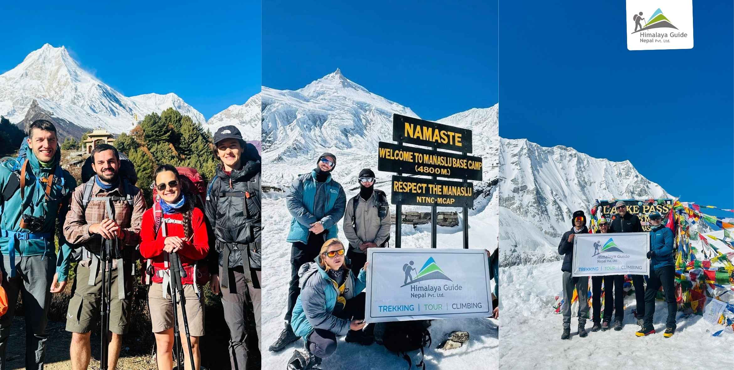
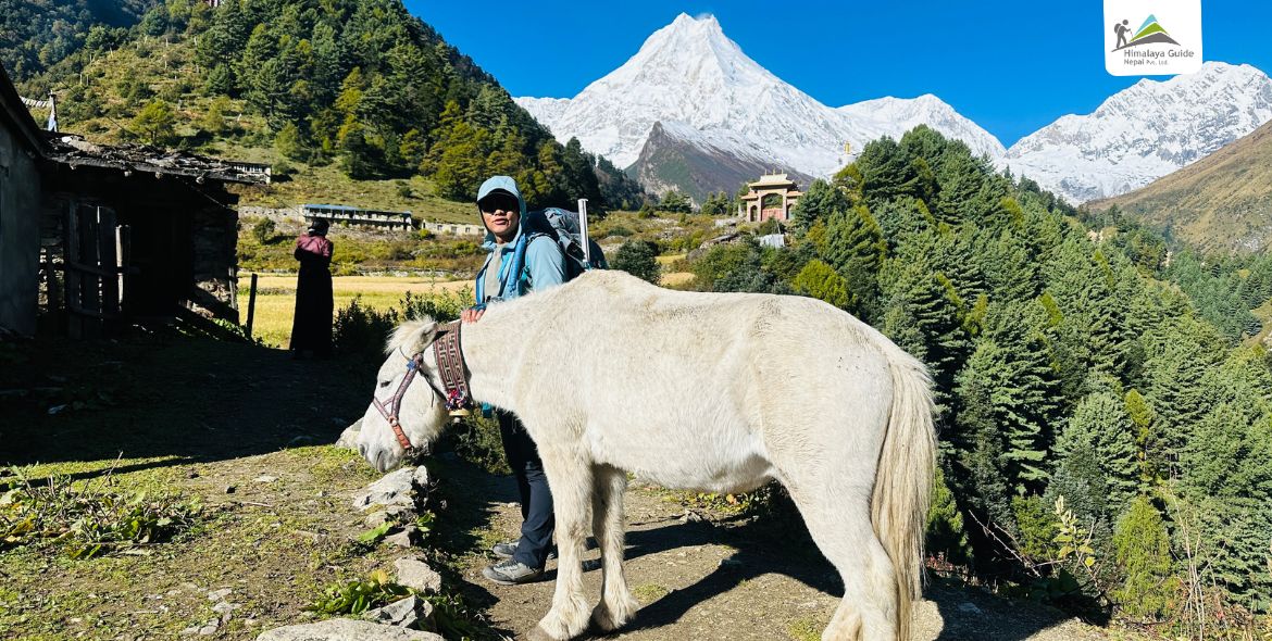
If you are a photographer looking for a remote Himalayan adventure in Nepal, the Manaslu Photo Tour can be the one you are searching for. This tour goes around Mount Manaslu (8,163 M), the eighth-highest mountain in the world, and offers you the best shots of snowy landscapes, blue glacial lakes, old monasteries, and Tibetan culture.

Life in this region follows old traditions, where people continue to farm, trade, and pray just as their ancestors did for generations. As you move around the villages, you will come across prayer wheels, chortens, and small gompas that showcase their devotion towards Buddhist culture. Located inside the Manaslu Conservation Area, this region protects forests, alpine land, and rare animal species such as the Himalayan tahr, blue sheep, and many birds that are worth capturing.

Unlike the busy trails of Everest and Annapurna, the Manaslu Circuit Trek is uncrowded. You won’t have tourists stepping into your photos, no long lines at viewpoints, and no noise to distract you while capturing your shots. And if you are worried about mountain views, there is no need; the region offers just as many peaks as the Everest area. You will see Himalchuli (7,893 M), Ngadi Chuli (7,871 M), Annapurna II (7,937 M), Himlung Himal (7,126 M), Kang Guru (6,981 M), Cheo Himal (6,820 M), and Ganesh Himal (7,429 M), along with many smaller peaks that add to the beauty of the region.

If you want photos that look real and genuine, this is your route. Pack your camera, plan smart, and book the tour with Himalaya Guide Nepal. The mountains will not wait, and neither should you.

Manaslu Photo Tour Highlights

  • Capture the ancient mani walls near Lho that are longer than 200 M.
  • Explore the Tatopani natural hot springs and the cantilever bridge.
  • Visit Syala village for the best panorama of 29 peaks, including Phungi, Manaslu, and Himal Chuli.
  • Document the Nubri Valley culture where the Tibetan language is still spoken.
  • Photograph Pungyen Gompa with the glacier backdrop that was destroyed by an avalanche in the past and later rebuilt.
  • Shoot the landscape transition from subtropical zones to alpine within a few days.
  • Capture Birendra Lake, where the water changes its color from blue-green to grey based on glacier sediment.

Manaslu Photo Tour Outline Itinerary

Route End Elevation Elevation Gain/Loss Duration Distance
Day 01 Arrival In Kathmandu, Nepal 1,350 M - 1 Hour Driving 6.2 KM
Day 02 Drive from Kathmandu to Machhakhola 869 M - 481 M 8 - 10 Hours Driving 155 - 160 KM
Day 03 Trek from Machhakhola to Jagat 1,400 M + 531 M 6 - 7 Hours Trekking 20 - 22 KM
Day 04 Trek from Jagat to Deng 1,860 M + 460 M 6 - 7 Hours Trekking 18 - 19 KM
Day 05 Trek from Deng to Namrung 2,630 M + 770 M 5 - 6 Hours Trekking 17 KM
Day 06 Trek from Namrung to Syala Gaun 3,500 M + 870 M 5 - 6 Hours Trekking 12.5 KM
Day 07 Photography Hiking To Pungyen Gompa & Trek to Samagaon 3,530 M + 30 M 4 - 5 Hours Hiking 12.5 KM
Day 08 Rest Day In Samagaon And Hike To Manaslu Base Camp 3,530 M 0 M 4 - 5 Hours Hiking 9 KM
Day 09 Trek from Samagon to Samdo 3,875 M - 867 M 3 - 4 Hours Trekking 8.2 KM
Day 10 Trek from Samdo to Larkya Bazaar (Dharmasala) 4,460 M + 585 M 3 - 5 Hours Trekking 6.5 KM
Day 11 Trek from Dharamsala to Bhimthang via Larkya La Pass 3,590 M + 646 M, - 1,156 M 7 - 9 Hours Trekking 24 - 25 KM
Day 12 Trek from Bhimthang to Dharapani 1,860 M - 1,730 M 7 - 8 Hours Trekking 16 KM
Day 13 Drive from Dharapni to Kathmandu 1,350 M - 510 M 7 - 10 Hours Driving 140 - 150 KM
Download PDF download

Manaslu Photo Tour Detailed Itinerary

Day 01 :

Arrival In Kathmandu, Nepal 

Drive Distance

6.2 KM

Drive Duration

20-30min

Highest Altitude

1,350 M

Place

Kathmandu

Meals

Dinner

Accommodation

Kathmandu Garden Home

A representative from the agency will meet you at the airport and assist with the transfer to your hotel. Keep your camera ready as you head to your hotel, as the drive offers incredible opportunities for candid photography, with colorful scenery, temples, and local markets.

In the evening, we will arrange a welcome supper, during which the trekking guide joins the group. This meeting set clear expectations for the days ahead and provided time to discuss the route, weather, and photography plans. It is also a good moment to check the gear and prepare for the journey into the Manaslu region.

Day 02 :

Drive from Kathmandu to Machhakhola and Photography

Drive Distance

155 - 160 KM

Drive Duration

8 - 10 Hours

Highest Altitude

1,350 M

Place

Machhakhola

Meals

Breakfast, Lunch, Dinner

Accommodation

Lodge

The journey begins early from Kathmandu and follows a long route through Malekhu, Dhading Besi, and Arughat before reaching Machhakhola. The first part of the road is smooth, but the second half is rough, narrow, and dusty. Do request a seat on the right side (when heading away from Kathmandu) for the best views of the Trishuli and Budhi Gandaki rivers. 

You can capture the interactions between the conductor and drivers, or children waving from roadside villages. Use a fast shutter speed (1/500s or higher) camera to counteract the bus vibrations. And also protect your sensor from the dust. Keep your camera inside a sealed dry bag or a plastic wrap. Only take it out for specific shots.

Day 03 :

Trek from Machhakhola to Jagat

Trek Distance

20 - 22 KM

Trek Duration

6 - 7 Hours

Highest Altitude

1,400 M

Place

Jagat

Meals

Breakfast, Lunch, Dinner

Accommodation

Lodge

Today, you’re moving deeper into the Budhi Gandaki gorge. The first settlement you’ll reach is a beautiful Gurung village (Khorlabesi). Look for traditional honey hunting gear or locals processing crops that are great for documentary-style photography. 

Further ahead, near Yaru Bagar, the route crosses a cantilever bridge attached to a cliff. It is also an example of great engineering work in Nepal. After that, the trial reaches Tatopani, known for its natural hot springs, where steam rises from stone taps where locals and trekkers wash their feet. 

The day ends at Jagat, a clean, flagstone-paved village known as the entry point into the Manaslu restricted area. It feels like a gateway in your photo story as well. 

Day 04 :

Trek from Jagat to Deng

Trek Distance

18 - 19 KM

Trek Duration

6 - 7 Hours

Highest Altitude

1,860 M

Place

Deng

Meals

Breakfast, Lunch, Dinner

Accommodation

Lodge

You begin another stunning day of hiking and photography after breakfast by traveling along the recently built jeep route. After a short walk, the road ends, and you’ll cross a suspension bridge. Trails then take you uphill to the Philim settlement. You can capture the chorten (Buddhist stupa) at the entrance and the terraced fields that look like a big green staircase from above.

This is the MCAP (Manaslu Conservation Area Project) checkpoint for tourists. We proceed by registering our permissions here. After arriving at Ekle Bhatti and walking for another 30 to 40 Minutes, you will stop for a delectable lunch. The next stage of our Manaslu Photo Tour continues through deep bamboo forests and the narrow gorge of the Budhi Gandaki River before reaching Deng.

Day 05 :

Trek from Deng to Namrung

Trek Distance

17 KM

Trek Duration

5 - 6 Hours

Highest Altitude

2,630 M

Place

Namrung

Meals

Breakfast, Lunch, Dinner

Accommodation

Lodge

On Day 05, you’ll officially enter the Nupri region, where the culture is purely Tibetan Buddhist. Mt Shingiri comes into view when you depart from Deng Village in the morning. You will be able to see the locals honing their craft in the fields and mules carrying the supplies during the day.

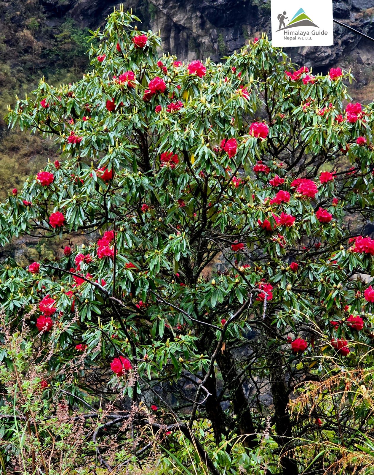
After a short trek, you’ll pause for lunch at Gyap, a charming village halfway through the journey. Following lunch, the pathways take you to Namrung Village across a rhododendron forest. As you go through the forest, you can see several birds, other creatures, and mountains such as Himal Chuli (7,893 M) and Ganesh Himal (7,422 M).

People in Namrung wear traditional Tibetan dress. Their weathered faces reflect the life in the mountains. Always ask “Photo chhap?” (May I take a photo?) A smile and a nod are usually a sign of permission.

Day 06 :

Trek from Namrung to Syala Gaun

Trek Distance

12.5 KM

Trek Duration

5-6 Hours

Highest Altitude

3,500 M

Place

Syala Gaun

Meals

Breakfast, Lunch, Dinner

Accommodation

Lodge

This is the day Mount Manaslu (8,163 M) will finally come into your frame. The first clear photo you can take is from Lihi village. Famous for its chortens and mani walls, the village is divided into upper and lower sections, and the upper section offers a fantastic “look-back” view of the Ganesh Himal range. 

The next is Lho village. This is a “bucket list” photography spot, known for the Ribung monastery. It is located above the hill, and photographers love capturing the monastery with the double peak of Manaslu rising right behind it.

Syala Gaun is the destination for the night. Many trekkers push to Samagaon, but Syala is the superior photography spot to capture Manaslu, Himal Chuli, Ngadi Chuli, and Peak 29 in one shot.

Day 07 :

Photography Hiking To Pungyen Gompa & Trek to Samagaon

Trek Distance

12.5 KM

Trek Duration

4-5 Hours

Highest Altitude

3,530 M

Place

Samagaon

Meals

Breakfast, Lunch, Dinner

Accommodation

Lodge

Instead of the direct route, you head to the Pungyen Glacier before descending to Samagaon for a visit to Pungyen Gompa. This monastery was destroyed by an avalanche in the 1950s (locals believed the mountain god was angry) and later rebuilt. You can capture the old grey stone of the Gompa and the Manaslu East Face using a wide-angle lens (16-24 MM).

From the monastery, you’ll descend back to the main trail and enter Samagaon. The village is a maze of stone houses. You can capture the “Kani” (entry gate), which is decorated with colorful ceiling paintings of Mandalas.

Day 08 :

Rest Day In Samagaon And Hike To Manaslu Base Camp

Trek Distance

9 KM

Trek Duration

4-5 Hours

Highest Altitude

4,800 M

Place

Samagaon

Meals

Breakfast, Lunch, Dinner

Accommodation

Lodge

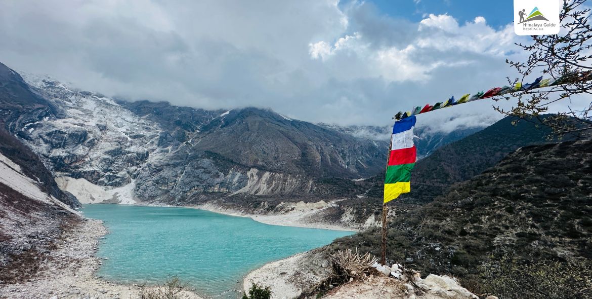
You’ll have a hot breakfast at the lodge, then hike to Mt. Manaslu Base Camp (4,800 M). The trail first follows the route toward Samdo, then turns left at Birendra Lake and continues all the way up to Base Camp. At Birendra Lake, the shot worth capturing is the reflection of the North Face of Manaslu in the meltwater. You have to arrive early (before 8:00 AM), before the wind picks up and ripples the surface.

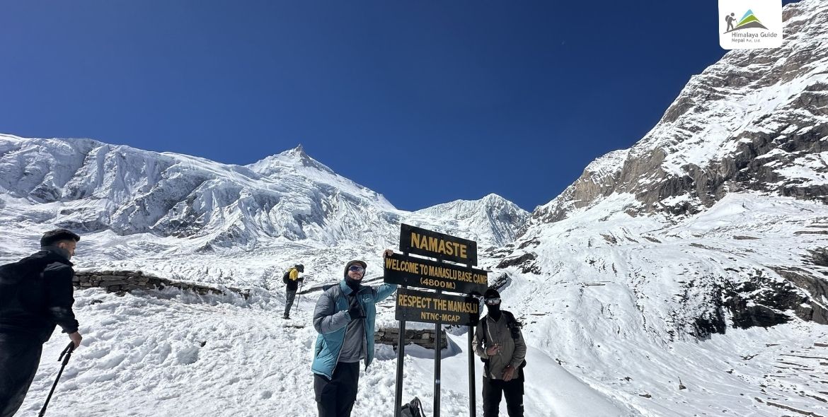
At base camp, you can see the “Yellow City” of expedition tents during the climbing season. The Manaslu Icefall, prayer flags (Lungta), and the signboard showing Manaslu Base Camp with its altitude are also worth capturing. By the time you reach Base Camp, the sun will be high, and this is a great time for Black and White photography. After taking photos, you’ll head back to Samagaon for the overnight.

Day 09 :

Trek from Samagon to Samdo

Trek Distance

8.2 KM

Trek Duration

3-4 Hours

Highest Altitude

3,875 M

Place

Samdo

Meals

Breakfast, Lunch, Dinner

Accommodation

Lodge

This is your “Culture & Livestock” photography day because the hiking time is low today. The trail moves close to the Tibetan border, and the surrounding begins to resemble the look of the Tibetan plateau. This route is known for yak caravans that carry goods between villages. Samdo Peak (Samdo Ri), in the background, adds another layer of beauty

Soon after trekking for 1 – 2 Hours, you’ll reach Samdo again. Go for a walk with the camera around the village and capture the flat rooftops covered with drying juniper, yak dung (used as fuel), and the unique stone houses that you may not have seen in other villages along the way.

Day 10 :

Trek from Samdo to Larkya Bazaar (Dharmasala)

Trek Distance

6.5 KM

Trek Duration

3 - 5 Hours

Highest Altitude

4,460 M

Place

Larkya Bazaar (Dharmasala)

Meals

Breakfast, Lunch, Dinner

Accommodation

Lodge

On Day 10, your Manaslu Photo Tour trek takes you from Saamdo to Dharmasala, also referred to as Larkya Phedi, an important stop before crossing the formidable Larkya La Pass. This is the most remote-feeling day because the trees disappear entirely and are replaced by scrub juniper. On the way to Larkya Bazaar from Samdo, you can take a picture of beautiful Naike Peak (6,211 M) and Larkya Peak (6,249 M).

Soon after a few hours’ trek, you’ll reach Salkhu Khola Valley, where you’ll trek on the edge of the Larkya Glacier and enter Dharmasala. This is not a village, but a high-altitude shelter. It completely relies on solar power and is overcrowded. Do not count on charging here; keep all your batteries inside your down jacket or sleeping bag.

Day 11 :

Trek from Dharamsala to Bhimthang via Larkya La Pass

Trek Distance

24 - 25 KM

Trek Duration

7 - 9 Hours

Highest Altitude

5,106 M

Place

Bhimthang

Meals

Breakfast, Lunch, Dinner

Accommodation

Lodge

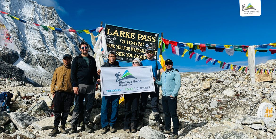
The day begins very early, around 3:00 to 4:00 AM, with a climb over rough moraine and frozen ground. You definitely need a headlamp for this part of the trek. Do follow your guide carefully until you reach the top of Larkya La Pass. Once you arrive, it will surely be the proudest moment of your entire trek. You can capture chorten draped in thousands of prayer flags with Annapurna II (7,937m) and Himlung Himal (7,126 M) in the background.

After spending a good time up there, you’ll descend towards Bhimthang, also called the “Valley of Rock.” The descent can be risky because of loose gravel and snow, so move carefully and watch your step. Looking back at the West Face of Manaslu and Phungi Himal (6,524 M) from Bhimthang. This is arguably the most beautiful sunset spot of the entire trip

Day 12 :

Trek from Bhimthang to Dharapani

Trek Distance

16 KM

Trek Duration

7 - 8 Hours

Highest Altitude

3,590 M

Place

Dharapani

Meals

Breakfast, Lunch, Dinner

Accommodation

Lodge

This is a spectacular day for photography as you leave the high-alpine rock and ice behind and plunge into some of the old and lush rhododendron forests of Nepal. Just outside the village after leaving Bhimthang, the trail offers a high vantage point overlooking the Ponkar Glacier. You can capture its grey rock and blue ice as well.

You follow this glacial river all day until you reach Habu (Old Gho) & Tilije villages. These are beautiful Gurung villages famous for apple orchards and apple brandy. You can take a rest here and sample the brandy, or buy some as souvenirs.

From there, you’ll cross a large suspension bridge where the Dudh Khola meets the Marsyangdi River, and then continue on to Dharapani for an overnight stay.

Day 13 :

Drive from Dharapani to Kathmandu

Trek Distance

140 - 150 KM

Drive Distance

220KM

Drive Duration

7 - 10 Hours

Highest Altitude

1,860 M

Place

Kathmandu

Meals

Breakfast, Lunch, Dinner

Accommodation

Lodge

The final day is a long journey that shifts from the mountain tracks of the Annapurna region back to the Kathmandu valley. You’ll start the drive early from Dharapani and head towards Besisahar, where you can see some of the tallest waterfalls in Nepal. Keep your camera ready for quick shots of water cascading hundreds of feet directly next to the road.

From Besisahar, the road is fully paved. You’ll follow the Marsyangdi River for the first half of the journey to Muglin, and then continue to follow the Trishuli River all the way to the entrance hill of Kathmandu. On the way, there will be a short stop for refreshments and lunch at a local restaurant, which gives you a chance to stretch your legs and enjoy some delicious Nepali cuisine.

Inclusion/Exclusion in Manaslu Photo Tour

Cost Includes

  • Pick up and drop services.
  • 2 Nights hotels in Kathmandu (before or after trek).
  • Bus ticket to Machha Khola by local bus.
  • Transportation along the trek.
  • Public bus back to Kathmandu.
  • Drop off at the hotel in Kathmandu.
  • Three meals a day (Breakfast, Lunch, and Dinner along the trek).
  • Lodge accommodation on the way (simple one).
  • Camera stand and other things to carry.
  • An Experience Guide (including their salary, equipment, insurance, lodging, and food)
  • Porter (carries luggage of 2 trekkers, including their salary, equipment, insurance, lodging, and food)
  • Equipment: Down Jacket, Sleeping Bags, Raincoat (for after the trek return).
  • Legal Documents (MCAP permit, Manaslu restricted area permit, Local Government, and ACAP).
  • Some dry and fresh fruits.
  • Farewell lunch or dinner.
  • Token of Love after trek.

Cost Excludes

  • Extra night accommodation in Kathmandu.
  • Travel insurance in cases in trekking.
  • Hot and Cold drinks such as Coke, Mineral Water, Beer, etc.
  • Personal expenses (laundry, bar bill, telephone, extra helper, battery charge, shower, boiled water, and some donations).
  • Tips for the guide and porter.

Manaslu Photo Tour Map

The Manaslu Photo Tour is a 12-day circular adventure organized by Himalaya Guide Nepal, designed for photography enthusiasts who want to capture beautiful landscapes, culture, and high-altitude scenery of the Manaslu region. The tour begins and ends in Kathmandu and follows a trekking loop around Mt. Manaslu (8,163 M).

The route heads north from Kathmandu by road to Arughat and Soti Khola before the trekking begins. Numbered stops mark key stops of the journey. Machha Khola is the first trekking halt along the Budhi Gandaki River, followed by Jagat. The trail climbs through Deng and Namrung, where rhododendron forests and mountain views make for photoworthy scenery.

Kathmandu → Machhakhola → Jagat → Deng → Namrung

Continuing upward, you’ll pass Shyala, where the first views of Mt. Manaslu reveal themselves, before reaching Samagaon (the largest village on the circuit). The final high-altitude trek takes you to Samdo near the Tibetan border, and then to Dharmasala/Larkya Phedi. After completing the pass, the trail drops down to Bhimtang and continues down to Dharapani, where the trek concludes before driving back through Besisahar to Kathmandu.

Namrung→ Shyala→ Samagaon→ Samdo→ Dharamsala→ Bhimtang→ Dharapani→ Kathmandu

The map also highlights notable peaks like Himalchuli (7,893 M), Ganesh Himal (7,422 M), Nagadi Chuli (7,871 M), and Shringi Himal (7,161 M), as well as lakes and monasteries on the secondary routes.

Manaslu Photo Tour Map Image Link

Download PDF download

Departure Dates for You

13 Days

Trip Days

27 Jul, 2026

Start Monday

8 Aug, 2026

End Saturday

10

Group Size

USD 1,270

Price

Booking Open

Status

Private Trip Booking

Prefer a more personal journey? Our private packages offer flexible dates, custom itineraries, and dedicated support—perfect for those seeking a tailored travel experience.

Manaslu Photo Tour Trip Information
family_star

Best Time for Manaslu Photo Tour

When you plan your trip, don’t just think about which season is easiest for walking; also, think about which season gives you the best light and weather for taking great photos. The two best times to visit are autumn (Sept – Nov) and spring (Mar – May). Here’s why they are best.

Aspect Autumn  Spring
Best For Peak visibility and sharpness Colors and biodiversity
Range of Vision Clarity after monsoon rains washes away dust Clear mornings with afternoon cloud/haze sometimes
Landscape Golden harvest fields and alpine meadows Blooming rhododendrons and greenery
Culture Biggest Hindu festivals like Dashain and Tihar Active village life as locals come back for the season
Temperature Cooler in late November Warmer daytime temperatures and moderate nights


fence

Manaslu Photo Tour Difficulty

The Manaslu Photo Tour is moderate to strenuous and needs an average level of fitness but not technical climbing skills. The trail reaches heights of around 5,106 M at Larkya La Pass, where the air has about 50% less oxygen than at sea level. This can make walking slower and more stressful during long uphill sections.

The route passes remote areas with limited facilities, which adds to the challenge. Teahouses provide food and shelter, but comfort is simple, and weather conditions can change quickly. Temperatures can drop below freezing at higher elevations during early mornings and nights, which can exacerbate the symptoms of altitude sickness.

Despite these challenges, the trek is achievable for most people who prepare well. Cardio, leg strength training 3–4 months in advance, and a slow pace during the trek can make a big difference. Many trekkers complete the Manaslu circuit photography trek each year without major issues, as long as they listen to their body and follow the itinerary plan.

attractions

Major Location Highlights During Photo Tour

During this photo tour, you’ll explore some of the most scenic spots in the Manaslu Region such as Samagaun, Lho Village, and Pungyen Gompa. These locations provide a variety of photography opportunities. Below, we’ve described these highlights in more detail to help you prepare.

Lho Village and Ribung Gompa

Lho Village 3180M
Lho Village 3180M

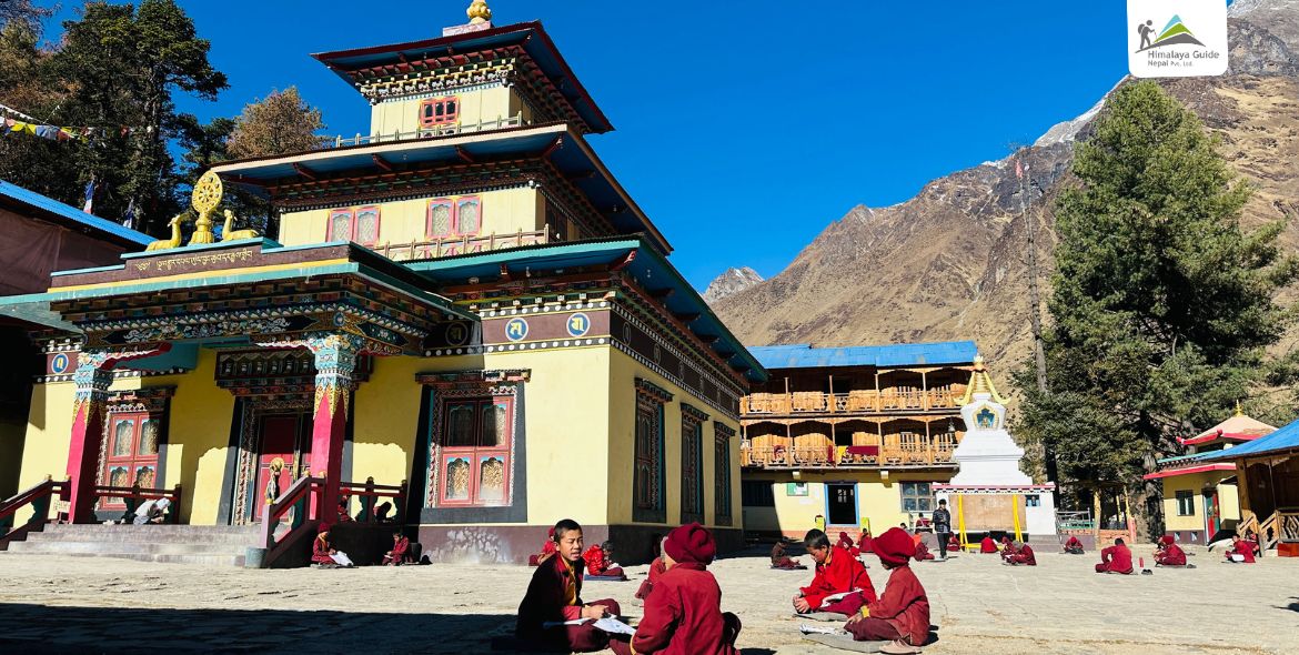
Lho and Ribung Gompa are two main cultural landmarks in the Manaslu Photo Tour. At Lho, you can explore traditional Tibetan-style houses, prayer flags, and the daily life of local Gurung and Tibetan communities. Just above the valley, you can see Ribung Gompa. Built in the 11th century, the monastery is home to over 100 monks, colorful murals, and statues. It also has a large prayer hall where both tourists and locals can take part in the rituals. Always ask for permission before taking photos inside this gompa.

Syala Gaun

Syala is considered the best viewpoint on the Manaslu Circuit because it is surrounded by Manaslu, Himal Chuli, Ngadi Chuli (Peak 29), and Ganesh Himal. The flat grazing area around the village is perfect for capturing this shot and for astrophotography due to the minimal light pollution. Numla Khola, located right next to the village, is also worth visiting, as it is a glacial river with fresh and clean water.

Pungyen Gompa

Pungen Monastery 4000M

Pungyen Gompa (or Pungen Gompa) is a 400-year-old Tibetan Buddhist monastery situated over 4,000 m above sea level. It is a meditation center for monks and locals of all faiths. From this top location, you can see Mt. Manaslu, the Manaslu Glacier, and the “three peaks” (Phun Gyen). Also, keep your camera ready for Himalayan tahr (mountain goats), which can sometimes be seen in the meadows.

Birendra Lake

Birendra Lake
Birendra Lake

Named after the late King Birendra Bir Bikram Shah, the lake is considered sacred by the local Nubri people, who decorate the area with prayer flags and stone cairns. This lake is formed by meltwater from the Manaslu Glacier and is famous for the reflection of Mount Manaslu and Himalchuli in its water. Situated at an altitude of 3,691 M it is the most popular side trip from Samagaon. 

Bhimthang

Bhimtang Tea Houses
Bhimtang Tea Houses


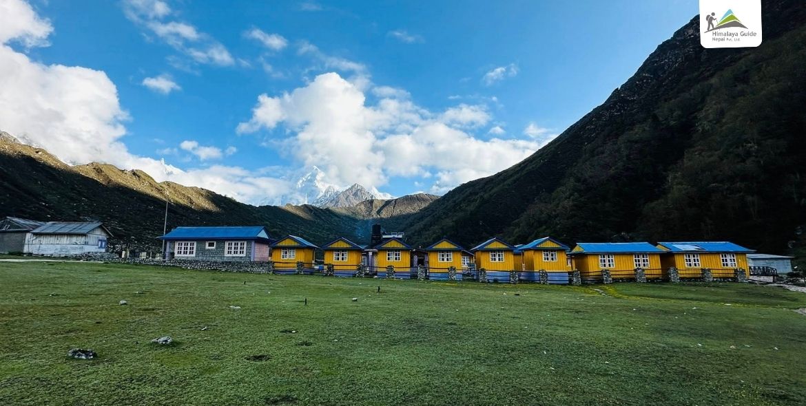
Bhimthang is a must-visit highlight on the Manaslu Photo Tour, famous for Mt. Manaslu, Himlung, Cheo Himal, Phungi Himal, Annapurna II, and Lamjung Himal views. It also offers a beautiful viewpoint where you can see the meeting point of three large glaciers (Ponkar, Kechakyu, and Suti) and the Ponkar Lake lying just between them.

Manaslu Photo Tour Vs Manaslu Circuit Trek

The key difference lies in pace and focus. While both cover the same 177 KM route, a Photo Tour looks at landscapes as a studio, whereas the Circuit trek approaches it as a physical challenge. The table below gives you a clear difference.

Feature Manaslu Photo Tour Manaslu Circuit Trek
Goal Capturing high-quality images of peaks and culture. Physical achievement of completing the 177 KM circuit
Duration 13 – 15 days 14 – 18 days
Side Trips Mandatory (Pungyen Gompa, Birendra Lake, MBC) Optional side trips based on group energy levels
Guide Type Specialized photography guide familiar with lighting Standard licensed guide (mandatory for restricted areas)
Porter Support May includes extra porters for heavy camera gear/tripods. Standard porter support (approx. 20 kg per porter)
Daily Routine Flexible hours, early starts/late finishes for light 6 – 8 Hours walking days

Manaslu Photo Tour Frequently Asked Questions

Ready to Start
Your Adventure?

Join thousands of happy travelers who
Choose Himalaya Guide Nepal Pvt.Ltd.

Plan Your Trip