
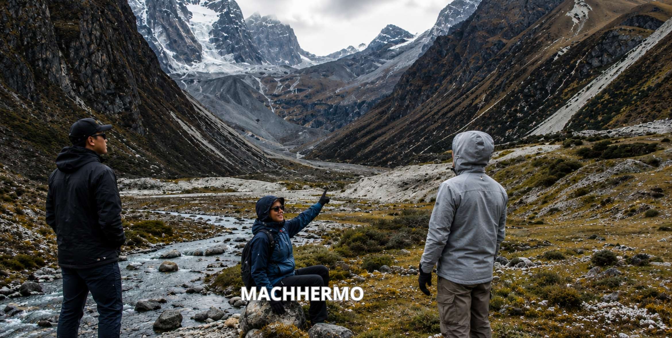
Dole to Machhermo is about 5 to 7 km and takes 3 to 5 hours with tea stops. You climb about 450 m and drop about 95 m, ending at 4,470 m. The trail is gentle, but the air is thin. Walk slowly, drink often and sleep the night in Machhermo before Gokyo.
This walk is Day 6 on the Gokyo Ri trek and the shortest walking day on the way to Gokyo Lakes. You walk about 5 to 7 km through yak pastures and small tea stops, with Cho Oyu (8,188 m) ahead of you most of the morning.
The walk is short, but it happens at high altitude. You start above 4,000 m and sleep at 4,470 m, where the air holds about 60 percent of the oxygen at sea level. That is why the day feels harder than the distance suggests.
Trekkers over 40 often ask about three things on this day: knee strain on the downhills, sleep at altitude and walking pace. This guide covers all three, along with the trail stage by stage.
Dole to Machhermo Quick Facts
| Fact | Detail |
|---|---|
| Distance | About 5 to 7 km |
| Walking time | 3 to 5 hours with tea stops |
| Start point | Dole, about 4,038 m |
| End point | Machhermo, about 4,470 m |
| Total climb | About 450 m up |
| Total descent | About 95 m down |
| Net height gain | About 430 m |
| Tea stops | Lhafarma and Luza |
| Trail surface | Dirt path, grassy slopes, one short icy dip in cold months |
| Arrival time | Around lunch |
| Region | Sagarmatha National Park, Khumbu |
| Trip day | Day 6 on our Gokyo Ri and Chola Pass treks |
You walk for about half a day and rest in the afternoon. The day before, from Namche to Dole, is longer and climbs more, so this shorter day gives your body time to adjust.
Elevation Gain Explained
Dole sits at about 4,038 m. You may also see 4,110 m or 4,200 m on some maps, because lodges spread up the hillside and people measure from different spots.
Machhermo sits at about 4,470 m. So the net gain is about 430 m. The trail also dips down twice, so your legs climb about 450 m in total and drop about 95 m.
| Height fact | Number |
|---|---|
| Dole | 4,038 m (13,248 ft) |
| Machhermo | 4,470 m (14,665 ft) |
| Net gain | About 430 m (1,410 ft) |
| Total climbing | About 450 m |
| Total descent | About 95 m |
| Oxygen compared to sea level | Roughly 58 to 60 percent |
Most of the climbing comes in the first 1 to 1.5 hours, right after breakfast. That matters because your body is still waking up after a night at 4,000 m.
Walk this first climb slowly. The rest of the day is gentler, and most groups reach Machhermo around lunch.
Why Trek Times Vary
This walk takes between 2 and 5 hours. The time depends on the walker and the trail conditions that day.
- How you slept in Dole, because a bad night at 4,000 m drains you
- Snow or mud on the trail, which slows every step
- Photo stops for Cho Oyu, which you will want to make
- Your age and fitness, which is completely normal
- How your body handles altitude that week
Slow walkers rarely get into trouble higher up. Fast walkers who race this day sometimes do, because the body needs time to catch up with the height. And there is no reason to hurry, since your lodge, your lunch and your afternoon are all waiting.
Trail Stages, Dole to Machhermo
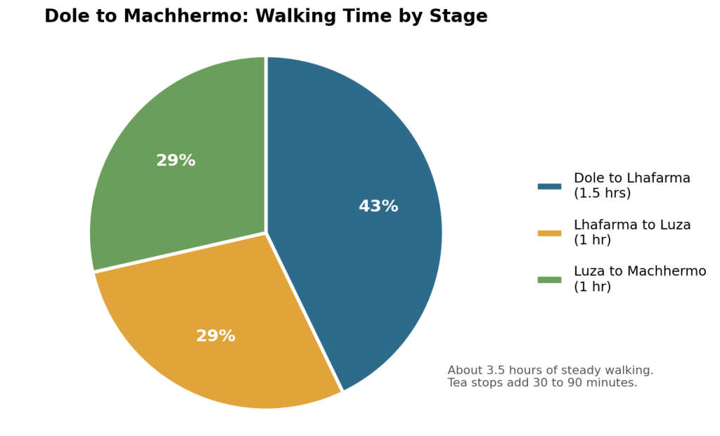
The walk splits into three parts, with a tea stop between each. Knowing the stages helps, because you always know how far the next rest is.
This pie chart shows how your walking time usually splits across the three stages, based on about 3.5 hours of steady walking.
| Stage | Time | Terrain | What you find |
|---|---|---|---|
| Dole to Lhafarma | 1 to 1.5 hrs | Short drop, then steady climb through juniper | Small teahouse |
| Lhafarma to Luza | About 1 hr | Gentle climb through yak pasture | Teahouses, lunch stop |
| Luza to Machhermo | About 1 hr | Stream crossing, grassy slopes, short descent | Lodges, village |
Dole to Lhafarma
You leave Dole after breakfast and drop down to a small stream. In autumn mornings and winter, this short slope can be icy. Take your trekking poles out before you start, not halfway down.
Then comes the steepest climb of the day. The trail winds up through low juniper bushes, and the last trees fall away behind you. You are above the tree line now, and you stay above it all the way to Gokyo.
Take this part slowly, because it holds most of the day’s height gain. Lhafarma, also spelled Lhabarma, has a small teahouse at the top. Sit down, order a milk tea and look back toward Kangtega and Thamserku.
Lhafarma to Luza
After Lhafarma, the trail eases off. You walk through open yak pasture with stone walls and a few low huts. Herders use these huts in summer when the yaks come up to graze.
You will likely pass yaks and dzo, a yak and cow cross, chewing grass by the path. Always step to the uphill side of the trail when they pass, so they cannot push you toward the edge.
Luza sits in a small side valley, out of the wind. Many groups stop here for tea or an early lunch. Dal bhat, noodle soup and tea are on most menus.
Luza to Machhermo
From Luza, you cross a stream and climb over grassy slopes. The ground feels soft and firm, a nice change from the rocky steps lower down.
Then you top a small rise and see Machhermo below you in a wide, flat bowl. A long rubble wall of glacier moraine sits behind it. The last part is a short walk down into the village.
By the time you arrive, most lodges have the stove going and lunch ready.
How Hard Is Dole to Machhermo Day?
Dole to Machhermo has an easy trail, but the high altitude makes it feel harder.
The path has no scrambling, no ropes, and no scary edges. If you walk an hour a day at home, you can handle the ground. But the air here holds only about 58 to 60 percent of the oxygen at sea level, so every step feels heavier than it looks.
| Factor | Rating | Why |
|---|---|---|
| Trail difficulty | Easy | Clear path, no technical parts |
| Altitude effect | Moderate to hard | You walk between 4,038 m and 4,470 m |
| Knee strain | Low to moderate | Two short downhills |
| Length | Short | Half a day of walking |
| Overall for 40+ | Moderate | Easy ground, thin air |
This day follows the biggest height jump of the trip, from Namche to Dole. So think of Day 6 as your recovery day. It stays short on purpose, so your body can catch up.
Walk slowly and rest in the afternoon, and most people in their 40s, 50s and 60s find it very doable. Most groups arrive around lunch.
Pacing Tips After 40
After 40, most people recover more slowly and feel downhills more in the knees. A few simple habits make this day much easier.
Protect Your Knees Early
Your knees work hardest on two short downhills. The first is the icy drop right out of Dole. The second is the walk down into Machhermo at the end.
Use two trekking poles on both and set them a little longer for the downhill. Take short steps and keep your knees soft. Your guide will walk at your pace, so there is no need to keep up with anyone.
Looking after your knees today matters, because you climb Gokyo Ri two days later.
Sleep, Water, Night Toilets
Sleep gets harder above 4,000 m for everyone, and older trekkers often notice it more. You may wake up two or three times in the night. Your breathing may feel odd for a moment.
Drink about 3 to 4 litres a day in small sips, because water helps your body cope with thin air. It also means night trips to the toilet. In Machhermo, the toilet may sit down a cold corridor or outside.
So get ready before bed. Keep a headlamp, a warm jacket and your shoes right beside you. The sleeping bag and down jacket in our package make those 2 am trips much easier.
Medicines to Discuss First
Many trekkers over 40 take daily medicine for blood pressure, cholesterol or sleep. Some of these can matter at altitude.
Talk to your own doctor before you fly. Ask about your regular pills and about altitude medicine. Bring a printed list, so your guide knows too.
We never tell anyone what to take, because that is between you and your doctor. But a 15 minute chat at home saves a lot of worry on the trail.
Views Along the Way
The views change quickly on this walk. You leave the trees behind and walk into open valley with rock, grass and glacier ahead.
First Look at Cho Oyu
For most of the morning, one big white mountain fills the end of the valley. That is Cho Oyu (8,188 m), the sixth highest mountain in the world. It sits right on the Nepal and Tibet border.
On windy mornings, you can see snow blowing off the summit. The mountain is still about 20 km away.
Turn around now and then too. Kangtega and Thamserku stand behind you, and Taboche and Cholatse rise on your right. Ask your guide to name each one at the Luza tea stop.
| Peak | Height | Where you see it |
|---|---|---|
| Cho Oyu | 8,188 m | Ahead, at the end of the valley |
| Kangtega | 6,782 m | Behind you |
| Thamserku | 6,608 m | Behind you |
| Cholatse | 6,440 m | To your right |
| Taboche | 6,495 m | To your right |
Ngozumpa Glacier Moraine
As you get close to Machhermo, a huge ridge of grey rock and gravel appears ahead. That is the end moraine of the Ngozumpa Glacier. At about 36 km, it is the longest glacier in the Himalayas.
It does not look like ice from here, because rubble covers the glacier. Tomorrow, on the walk to Gokyo, you climb along its side and see its real size.
Machhermo sits just below this moraine.
Life in Machhermo Village
Machhermo is small. A cluster of stone lodges, a few prayer flags, a stream and wide yak fields. No road, no cars and no real shops.
Teahouses, Power and Wi-Fi
Lodges here are simple. Your room has two single beds, a thin mattress and a blanket. Walls are thin and rooms stay cold, so your sleeping bag does the real work.
| Facility | What to expect |
|---|---|
| Rooms | Twin beds, thin mattress, blanket, no heating |
| Toilets | Mostly shared, some attached in a few lodges |
| Dining room | Heated by a stove in the evening |
| Food | Dal bhat, noodle soup, fried potatoes, eggs, tea |
| Charging | Solar, costs extra, slow on cloudy days |
| Hot shower | Costs extra, not always available |
| Wi-Fi and signal | Patchy |
| Shops | None worth relying on |
The dining room is the only heated room in most lodges. In the evening, the owner lights the stove, and everyone gathers around it with tea. Order dal bhat, because you get free refills and the energy lasts.
Charge a power bank in Namche and pack a few wet wipes. Expect weak phone signal and slow Wi-Fi.
The Machhermo Yeti Story
Machhermo has one odd claim to fame. In 1974, a young Sherpa woman herding yaks near the village said a strange creature attacked her and killed some of her animals. People still call it the most famous yeti report in Nepal.
Local guides know the story well, so ask yours about it over dinner.
Medical Help Near Machhermo
For 17 years, volunteer doctors ran a rescue post in Machhermo with a daily talk on altitude sickness. That post closed after the 2019 season.
So plan as if a doctor is a long way away. Tell your guide about a headache early, not after it gets bad. Your guide carries a first aid kit and checks on you every evening.
You also need travel insurance that covers helicopter rescue up to at least 6,000 m, because Gokyo Ri and Renjo La both top 5,300 m. Check the age limits on your policy too, since some plans cap cover for older travellers. It is the one paper you hope you never use.
Your Afternoon Acclimatisation Hike
You reach Machhermo by lunch, which leaves a long afternoon. How you spend it changes how you feel at Gokyo.
After lunch and a short rest, walk slowly up the ridge above the village for 30 to 60 minutes. Then come back down to sleep. Guides call this “climb high, sleep low”, and it helps your body adjust before tomorrow.
Skip it if you have a headache or feel sick. Rest is the better medicine then. Lie down, drink water and tell your guide how you feel.
The rest of the afternoon is yours. Sit in the sun with ginger tea, write in your journal or watch the yaks wander past. Resting is part of acclimatisation at this height.
Warning Signs to Turn Back
Most trekkers feel a mild headache or tiredness here. It usually passes with rest and water.
Some signs mean you need to go down, not wait. Tell your guide straight away if you notice any of these.
| Sign | What it may mean | What to do |
|---|---|---|
| Headache that gets worse after rest and water | Worsening altitude sickness | Tell your guide, do not go higher |
| Throwing up or no appetite for dinner | Worsening altitude sickness | Rest, do not go higher |
| Out of breath while sitting still | Possible HAPE | Go down now |
| Wet cough or rattle in the chest | Possible HAPE | Go down now |
| Stumbling or confusion | Possible HACE | Go down now |
HAPE and HACE can turn dangerous within hours, even for fit people. The cure is to go down, and from Machhermo that means back toward Dole or lower.
Your guide makes that decision. One night lower down and a slow walk back up is a normal part of trekking at this height.
Best Months for Dole to Machhermo
October and November bring the clearest weather. The monsoon has just ended, so Cho Oyu looks sharp in the morning. Nights drop around freezing, but days feel sunny and dry.
| Season | Months | Trail | Views | Our take |
|---|---|---|---|---|
| Autumn | Sep to Nov | Dry | Clearest | Best time |
| Spring | Mar to May | Dry, warmer | Good, cloudier afternoons | Great second choice |
| Winter | Dec to Feb | Snow and ice | Clear but very cold | Tough trekkers only |
| Monsoon | Jun to Aug | Muddy | Mostly hidden | Not advised |
Spring comes a close second. It is a little warmer, and rhododendrons bloom in the forests below Dole. Clouds build more in the afternoon, so start early.
Lodges on this route stay open in autumn and spring. Some close in winter.
Where This Day Fits
Seeing the whole trip helps you understand this short day. Dole to Machhermo is Day 6 on our 12 day Gokyo Ri trek.
| Day | Route | Sleeping height |
|---|---|---|
| 5 | Namche to Dole | About 4,038 m |
| 6 | Dole, then Macheremo | 4,470 m |
| 7 | Machhermo to Gokyo | About 4,790 m |
| 8 | Gokyo Ri sunrise, back to Gokyo | About 4,790 m |
Day 7 continues to Gokyo, and our Machhermo to Gokyo guide covers that stage. After Gokyo, the routes split. Our Everest Gokyo Ri trek crosses Renjo La Pass, and our Chola Pass trek crosses Cho La to Everest Base Camp.
You can compare both on our Everest treks page. Either way, Day 6 sets you up for everything after it.
Extra Night Worth It?
Some trekkers add a second night in Dole or Machhermo. For many people over 40, that is a smart choice.
An extra night makes sense if this is your first time above 4,000 m, if you slept badly in Dole, or if a mild headache won’t go away. It also makes sense if you would rather enjoy the trip than rush it.
It adds one more day on the trail and one more night of lodge and meals.
We build custom itineraries all the time. Tell us your age, fitness and dates, and our team will tell you if an extra night helps.
Dole to Machhermo FAQs
How far is Machhermo from Dole?
How long does the walk take?
Can I skip the night in Machhermo?
Is it Machhermo, Machermo or Dhole?


