
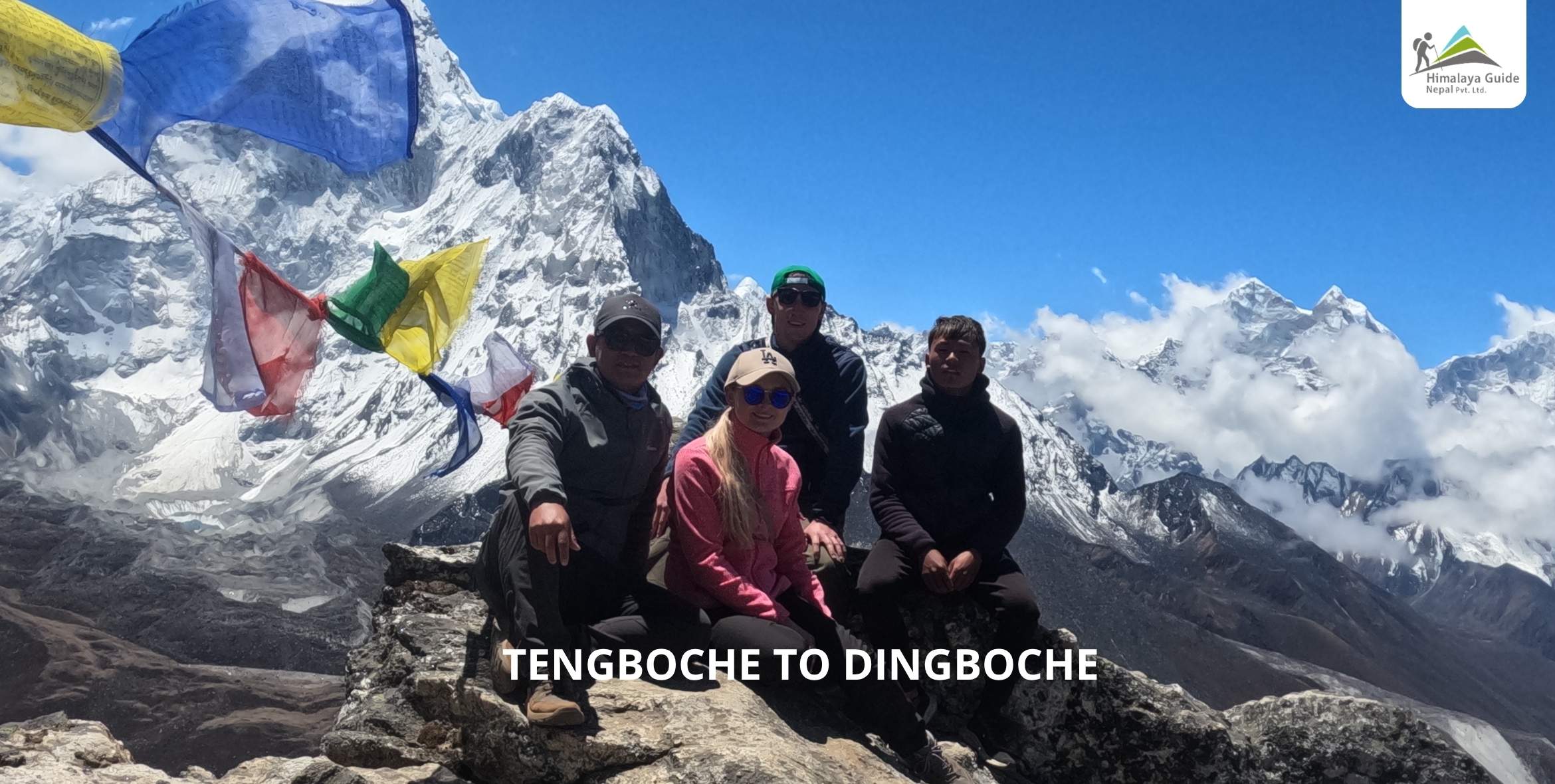
The trek from Tengboche to Dingboche covers around 10 to 11 kilometers and usually takes 5 to 6 hours, making it one of the most important stages of the Everest Base Camp Trek. You begin at 3,867 meters and finish near 4,360, with a drop through rhododendron woodland to the Imja Khola, an uphill push past Pangboche, and a final stretch across open alpine ground into Dingboche. Nothing about the surface underfoot is technical. It’s the thinning air that turns this leg tougher than anything walked before it.
I’ve led parties down this exact stretch since 2008, and one thing never changes. Hikers feel confident coming off Tengboche. The woods stay cool there, footing’s simple, so people lock into a rhythm that would suit them just fine back at sea level. Then Pangboche shows up, the path climbs past 4,000 meters, and that easy rhythm starts working against them. Curiously, the strongest athletes rarely finish this day in the best shape. It’s the patient ones, the water-drinkers, the folks who refuse to race the clock early, who land in Dingboche feeling solid.
Major Location Highlights of Tengboche to Dingboche Route
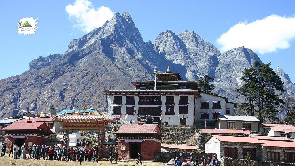
Tengboche Monastery: The Spiritual Heart of the Khumbu
At 3,867 meters sits Tengboche Monastery, the biggest gompa anywhere in the Khumbu Valley. Quite a few trekkers plan their departure to catch the morning chanting held inside. Picture the courtyard on a clear dawn: Everest, Lhotse, Nuptse, Ama Dablam, stacked together in a single frame. Then, almost instantly, the forest swallows it whole.
The Imja Khola Suspension Bridge
Ninety minutes beyond the monastery, the path drops through rhododendron toward Deboche before meeting the Imja Khola. This river hauls meltwater down from the Khumbu Glacier system, the very ice mass that later brushes past Everest Base Camp near the Khumbu Icefall. A suspension bridge, strung with fluttering prayer flags, gets hikers across. Here’s the low point of the entire day. Height only accumulates from this spot onward.
Pangboche Village: Ancient Culture and History
Roughly 3,985 meters up sits Pangboche, home to the Khumbu’s oldest monastery and its highest year-round settlement, not a seasonal outpost like some nearby hamlets. Potato and buckwheat get farmed here inside a frustratingly narrow growing window. Yak caravans bound for Chhukung Valley frequently bottleneck near the entrance, which honestly makes for a decent excuse to catch your breath. Ten genuine minutes here beats rushing straight through, since this place still runs on customs barely touched by decades of passing trekkers.
Panoramic Views of Ama Dablam
Almost the entire walk toward Dingboche keeps Ama Dablam in frame, its jagged ridge morphing with every bend. Mountaineers have chased its technical faces for generations now. Further on, near Lobuche and Pheriche, the same summit reveals itself from completely different angles. Twenty years of walking past this mountain, and somehow I still stop to stare each time.
The Alpine Plateau of Dingboche
Suddenly, once the last climb tapers off, Dingboche opens into view: a broad basin ringed by stone walls, potato fields, buckwheat plots, and peaks soaring past 6,800 meters. Adjusting to the thin air genuinely matters here in a way it didn’t back at Tengboche or Pangboche. That single fact explains why nearly every itinerary schedules a rest day the moment groups arrive.
Tengboche to Dingboche Route Key Information
Tengboche to Dingboche trek takes 5-6 hrs & covers a 10-11 km distance, which is a moderately difficult day in the Everest Base Camp trek itinerary. But make no mistake, altitude runs this show, not the ground beneath your boots.

Tengboche to Dingboche Distance
Measured in a straight line, Tengboche to Dingboche is 10 to 11 kilometers between the villages. The path, however, refuses to climb in one clean sweep. Descending toward the Imja Khola erases roughly 250 meters before the ascent resumes and eventually overtakes the starting point entirely. Add the drop and the reclimb together, and total climbing lands closer to 700, maybe 750 meters.
Tengboche to Dingboche Elevation Gain & Acclimatization Strategy
Above 3,500 meters, blood oxygen starts a real decline, noticeably so. That’s exactly why Tengboche to Dingboche trek day’s modest net elevation figure undersells what your body actually experiences. Drink three to four liters daily. Ease the pace once Pangboche is behind you. Common enough: a headache, a dulled appetite by afternoon. Usually that just signals slow down, nothing more drastic. Seasoned guides, meanwhile, spot fatigue before a single word gets said, sometimes just from noticing how a backpack rides differently than it did that morning.
Difficulty of Tengboche to Dingboche Route
Solid ground the entire route, clear stone sections, zero scrambling anywhere along this stretch. Altitude, paired with that drop-then-climb rhythm, causes nearly all the trouble here. The terrain itself stays blameless. Strong hikers who brush off pacing advice often end up struggling harder than cautious beginners ever do.
Accommodation & Food During Tengboche to Dingboche Route
Deboche, Pangboche, and Shomare all offer teahouses along the way, and most groups grab dal bhat, noodle soup, or momos somewhere in Pangboche or Shomare. By evening, Dingboche has dozens of lodges ready: twin beds, shared bathrooms, a dining hall heated by a central stove burning through the night. Showers turn tepid fast once the sun dips behind the ridgeline, so cleaning up before dinner beats waiting until sunrise. This is a real accommodation & food expectation to set for the Tengboche to Dingboche route.
Best Time to Trek From Tengboche to Dingboche
Spring and autumn win for clear skies, hands down. October and November especially deliver sharp, unobstructed views, though Dingboche still drops below freezing overnight no matter the calendar month. Monsoon season, on the other hand, turns everything to mud and buries Ama Dablam behind cloud most mornings. Winter stays cold, sure, but quiet too, and a clear winter day here is genuinely tough to top for photography.
Tengboche to Dingboche Route Breakdown
Your day begins with a descent through pine and rhododendron woods from Tengboche Monastery toward Deboche, which can be slick with mud if it rained overnight. After a brief flat stretch in Deboche, you reach the lowest point of the journey: the Imja Khola suspension bridge, where prayer flags snap in the wind.
Immediately after crossing the river, the steady climb to Pangboche begins as the forest gives way to stone walls and barley terraces. This village is the highest permanent settlement in the Khumbu and features an ancient monastery, making it well worth a genuine pause rather than a hurried walk-through.
Past Pangboche, the ascent continues through Shomare and Orsho. Here, trees completely vanish into open alpine scrub, and breathing becomes noticeably harder regardless of your fitness level. Daily yaks traverse this stretch, and a slow herd can easily add ten or fifteen minutes to your timing. This thin air is exactly where rushed trekkers and patient ones begin to look entirely different.
The final hour brings you across open, wind-battered terrain above the tree line, where gloves and a windproof layer are essential even under a bright sun. Eventually, the trail opens into the stone-walled fields of Dingboche, with Lhotse and Island Peak towering behind. Arriving here concludes the day’s climbing and brings you to the crucial acclimatization stop scheduled before pushing onward to Lobuche and Base Camp.


