
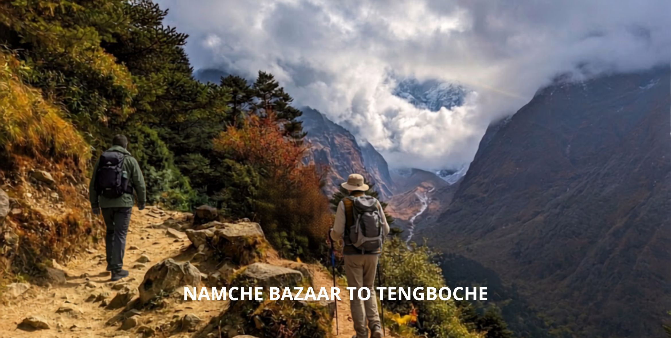
The distance from Namche to Tengboche is 10km & takes 5 to 6 hours, with Kyangjuma, Sanasa, & Phunke Tenga route highlights along the way. You start at 3,440 meters and end at 3,867 meters. But the trail drops toward the Dudh Koshi River first, down near 3,250 meters, before it climbs back up hard. You will pass Kyangjuma and Sanasa, cross a suspension bridge, and finish at Tengboche Monastery, one of the best viewpoints for Everest on the whole trek.
One thing before you start walking. You already did the Everest View Hotel side trip during your acclimatization day in Namche. So skip that route today. Stick to the lower main trail and save the energy. You’ll want every bit of it for the climb ahead.
| Segment | Distance | Walking Time | Elevation Change |
| Namche to Kyangjuma | 2.5 km | 45 – 60 min | Mostly flat, slight gain |
| Kyangjuma to Sanasa | 1.5 km | 25 – 30 min | Flat, small descent begins |
| Sanasa to Phunke Tenga | 3 km | 60 – 75 min | Drops toward 3,250 m |
| Phunke Tenga to Tengboche | 3 km | 90 – 120 min | Climbs to 3,867 m |
What to Expect on the Namche to Tengboche Trail
Everyone calls the Namche to Tengboche trek the most scenic day on the Everest Base Camp trek. And it is. But the trail loses altitude before it gains any, and that detail alone changes how you should ration your energy today.
Namche Bazaar to Kyangjuma
Leaving Namche means climbing a short staircase out of the town’s amphitheater bowl first, about 10 minutes of stone. You leave the shops and bakeries of Namche behind, and the trail goes quiet fast, the town noise fading within minutes. At the top, the trail levels out onto a wide path cut into the hillside, and Namche’s rooflines drop out of view behind you.
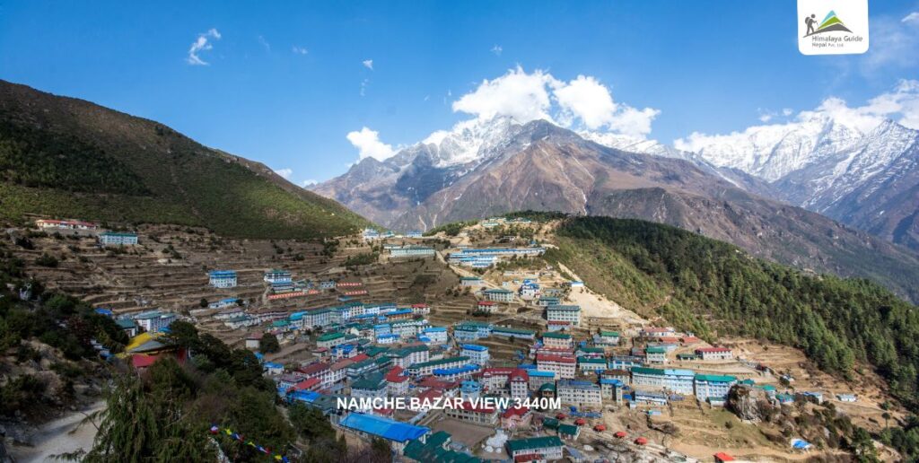
For the next 2 kilometers, roughly 30 to 35 minutes, walking stays flat and easy. Everest and Ama Dablam sit in the distance during walking. You’ll pass small whitewashed chortens along the Namche to Tengboche trail edge, spaced every few hundred meters, each one topped with a narrow spire.
Skip the Khumjung Route Today
You’ve already been up to the Everest View Hotel earlier, say, so there’s no reason to climb toward Khumjung again. The detour to the Everest View Hotel adds an hour of walking and 150 meters of extra climbing you don’t need right now.
Stay on the lower main trail instead. It stays flat, keeps your legs fresh, and puts you in Tengboche with something left in the tank for the climb waiting past Phunke Tenga.
Trail Surface Till Kyangjuma
This stretch is well graded, wide enough for two trekkers to walk side by side. One section near the Namche checkpoint, around the 500 meter mark, holds ice through December and January where the sun barely reaches. Poles help more here than almost anywhere else on this route.
You’ll also pass mani walls in this stretch, long stone walls carved with prayer inscriptions. Tradition says to keep them on your left, so walk on the right side of the trail when you reach one.
Kyangjuma to Sanasa
Kyangjuma sits at the 2.5km mark, about 45 minutes out of Namche. This is where the trail from Khumjung would normally rejoin the lower path, though you’re skipping that today. A couple of teahouses and some flat stone benches make this a natural pause point anyway.
From Kyangjuma, the trail stays flat for another 1.5 kilometers, roughly 25 to 30 minutes, tracing open hillside above the valley.
Sanasa is the last real market stop before Tengboche. Maybe eight or ten small stone-and-timber stalls sit right along the trail. Gloves, wool hats, snacks, basic first aid supplies. A few stalls even sell hand-knitted yak wool socks made locally. Prices run higher than Namche, so buy what you need here rather than hoping for better further along.
Sanasa sits at roughly the 4-kilometer mark, reached about 70 to 75 minutes after leaving Namche. Past this point, the flat walking ends. The trail tips downward through open, sun-exposed terraces, and the descent toward the river begins in earnest.
Sanasa to Phunke Tenga
Over the next 3 kilometers, about 60 to 75 minutes, the trail loses close to 200 meters, sliding down through scrub and scattered pine toward 3,250 meters. You’ll spot the teahouse roofs of Phunke Tenga on the valley floor long before you reach them.
It catches a lot of first-timers off guard. Why would the trail go down before Tengboche, when Tengboche sits higher than Namche Bazaar? Because that’s just the shape of this valley.
Suspension Bridge at Phunke Tenga
At the bottom, right after 7 kilometer covered, a steel cable suspension bridge crosses the Dudh Koshi River. Short by Khumbu standards, 40 to 50 meters end to end, strung with faded prayer flags along both cables. The water below runs fast, milky grey with glacier silt from higher in the valley. The suspension bridge crossing takes under two minutes.
Water Powered Prayer Wheels
Right beside the bridge sits a small wooden shed with a waterwheel turning at its base, driving a set of prayer wheels on the river’s current alone. Most trekkers photograph them without knowing what they’re looking at. They’re mani wheels, cylindrical drums packed with printed prayer scrolls, spun continuously by moving water, day and night, with no one touching them.
Phunke Tenga itself is just three or four teahouses clustered here. This is the last low-altitude crossing before the trail commits to climbing for the rest of the day.
Phunke Tenga to Tengboche
This is the steepest single climb of the day, roughly 600 meters of gain packed into 3 kilometers, taking 90 minutes to 2 hours depending on pace. Almost none of it flat.
The Rhododendron Switchbacks
The trail zigzags up through rhododendron and pine, tight switchbacks stacked one above the other for the first 2 kilometers. In spring the blooms turn the whole hillside red and pink, thick enough in places to close over the trail like a tunnel. Forest cover blocks the wind. Sounds nice, right? It also traps heat, so you’ll sweat here more than the altitude number on your watch would suggest.
Roughly halfway up, around the 1.5 kilometer mark from Phunke Tenga, the trail crosses a narrow wooden footbridge over a side stream, barely 3 meters across. Good spot to refill a bottle before the final push.
Pacing This Climb Specifically
Slow down before the switchbacks start, not once you’re already inside them. Two natural rest points exist on this stretch. The first comes about a third of the way up, roughly 40 minutes in, where the trail flattens briefly onto a wide dirt shelf. The second sits just below the treeline, about 20 minutes short of Tengboche, right where the forest starts thinning and the monastery first comes into view above you. Use both. Your legs will thank you tomorrow.
Arriving at Tengboche
The forest breaks open right at the top, close to 4,900 meters of walking behind you for the day, and the monastery sits on a wide, flat ridge with mountains on nearly every side. It’s the highest point most trekkers have stood on so far. It feels like it, too.
Tengboche Monastery Visiting Notes
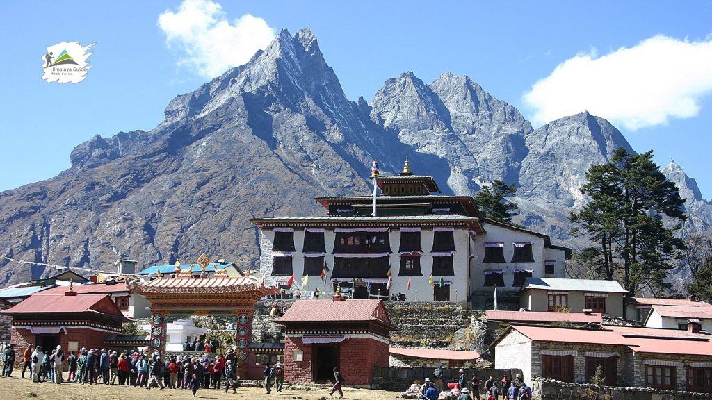
The monastery is a large white building with a red and gold trimmed roofline, rebuilt in the 1990s after a fire, fronted by a wide courtyard where trekkers gather before the afternoon prayer session. Prayers run most days around 3pm, lasting 45 minutes to an hour, and visitors are welcome to sit quietly along the back wall. Remove your shoes before entering. Keep your voice down. And ask before photographing the wall murals or the large seated Buddha statue inside. These aren’t just decoration to the monks who live here.
The full view of Ama Dablam, framed directly behind the monastery roofline, only appears once you clear the last switchback and step onto the ridge itself, the final 20 meters or so. Lower down, trees block nearly all of it. That last short stretch, maybe 30 seconds of walking, is where the whole day pays off in one turn of the trail.
Tengboche or Deboche for the Night
Most trekkers assume they should stay right at Tengboche. Plenty do after Namche to Tengboche hike. But Deboche sits twenty minutes further down the far side of the ridge, quieter, with fewer trekkers competing for rooms once peak season hits.
We’ve booked trekkers into both over the years. It usually comes down to one thing. Want the monastery at sunrise, before the trail traffic shows up? Stay at Tengboche. Want a calmer night’s sleep after a long day? Deboche wins.
Why Deboche Matters for Acclimatization
This stage climbs from Namche Bazaar to Tengboche, then continues a further 15-20 minutes downhill through rhododendron forest past the monastery to reach the overnight stop at Deboche. Although Tengboche is the day’s high point and main stop for views and the monastery, we push on to sleep in Deboche, which sits slightly lower and offers a warmer, more sheltered overnight than Tengboche itself. Ten kilometers from Namche to Tengboche doesn’t sound like much on paper. But 600 meters of climbing, packed into a single afternoon push after an earlier drop, makes this one of the more physically demanding days on the route, and you haven’t even reached the high passes yet.
Our guides treat this stage as a controlled push, not a rest day. It sits early enough in the schedule that a strong effort here sets the tone for how your body handles altitude later at Dingboche and beyond. Get this day right, and the harder days ahead start to feel manageable.


