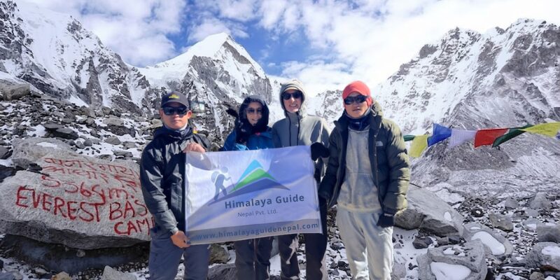
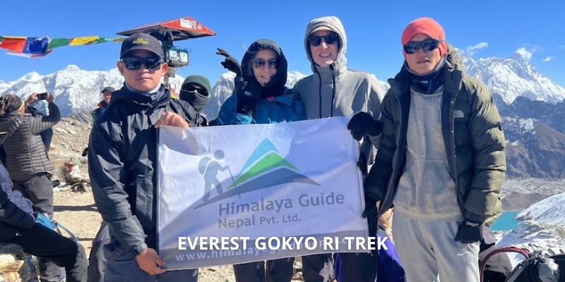
How to do the Gokyo Ri Trek in the Everest Region?- Glacier Lake in Nepal

UPDATED ON 7 January, 2024
How to do the Gokyo Ri Trek in the Everest Region?- Glacier Lake in Nepal

An estimated 40,000 trekkers depart from Lukla each year in an attempt to reach Everest Base Camp, the most well-known campsite on the planet. Along the journey, on the treks, and in the Sherpa communities, things might get lively. Is there another, less-traveled path that nevertheless allows you to see the tallest peaks in the world? Indeed, there is! The best-kept secret in the Everest region is the Gokyo Valley. Imagine views of four mountains rising beyond 8,000 meters, the longest glacier in Nepal, and emerald mountain lakes. It seems too wonderful to be true, doesn’t it? So, let’s explore How to do the Gokyo Ri Trek in the Everest Region. 

Why do the Gokyo Ri Trek in Everest Region 

An excellent substitute for the Everest Base Camp Trek is the Gokyo Trek. For five reasons, we genuinely like to think it’s superior.

1. Fewer crowds

We adore the fact that there aren’t many other hikers. Enjoy a solitary trek amid a stunning environment.

2. The Lakes at Gokyo

Examine the images below for this chapter. Should we elaborate further?

3. The glacier at Ngozumpa

The Ngozumpa Glacier is the biggest glacier in Nepal and the entire Himalayas, for that matter though this may not be widely known. See reason number four for the best view, which is from the summit of Gokyo Ri.

4. Gokyo Ri and Valleys

We can only describe the vista from the 5,357-meter top in superlatives. Mount Everest, the world’s tallest freshwater lake system, the longest glacier in the Himalayas, and four more summits rising to elevations of above 8,000 meters. Summed up in a word: AMAZING.

5. Local villages

To a certain degree, the Gokyo Valley’s communities remain untouched by tourists. The people are pleasant, the scenery is breathtaking, and the pace is leisurely.

How to do Gokyo Ri Trek in the Everest Region

The EBC treks share the section between Namche Bazaar and Lukla. The villages are lively and the trail is packed with trekkers. The largest settlement in the Everest region, Namche Bazaar is regarded as the Sherpa capital of Khumbu. The route splits off a little to the north of Namche. The trail to the base of Mount Everest descends to the Dudh Koshi River. The trail that continues climbing reaches the hamlet of Gokyo by climbing the valley west of Everest.

This little stone-housed hamlet is one of the world’s highest permanent villages, located at the base of Gokyo Ri. Gokyo is a significant hub in the area, situated 4,790 meters above sea level. Squeezed between Lake Dudh Pokhari and the Ngozumpa glacier, the setting is quite breathtaking. Additionally, it serves as the starting point for both the 5,360-meter-high Renjo La mountain pass and the Gokyo Ri trip. 

A temple dedicated to the Hindu gods Vishnu and Shiva is located on the western side of Gokyo Lakes, which is revered as the residence of the serpent god Nag Devata, drawing an average of 7,000 pilgrims each year. This region has historically been protected since it is thought that the birds and fauna there shouldn’t be damaged. 

Difficulty Level of Gokyo Ri Trek in the Everest Region

Does going off the usual path imply that there is no trail at all or that the track is in poor condition? Generally speaking, there is some truth to that. A recognized track, like the Everest Base Camp route or the Annapurna Circuit, gets increasingly worn the more frequently people walk on it. The Gokyo Trek is a little more difficult in that regard. Particularly if you undertake our 11-day Gokyo Ri trek with the Renjo La crossing, the path is more rugged.

It’s difficult to focus on your footing when there are such breathtaking sights all around you. However, it is still walking as opposed to climbing. What made the trek the hardest? The high elevations, for sure. The highest location to stay along the trip is the town of Gokyo, which is already 4,790 meters above sea level.

At 5,357 meters, the summit of the “hill” Gokyo Ri is easily higher than any mountain in Western Europe or the Lower 48 states of the United States. We’ll provide advice on avoiding altitude sickness and climbing a peak this high later in this article. So, how challenging is the Gokyo Trek? Not in that way. Is it difficult? Yes, indeed

Treks to take to reach the Gokyo Lake and Gokyo Ri

Gokyo Lake

There are numerous approaches to view the Gokyo region’s highlights. You can undertake the Everest Base Camp Trek in conjunction with the Three High Passes, or you can undertake the dedicated Gokyo Ri or Gokyo Lake Treks. Alternatively, you might just include the Gokyo Lakes and expand on the Everest Base Camp Trek.

Best Time for Gokyo Ri Trek in Everest Region

There are four distinct seasons in Nepal, which include the Everest Region and most other trekking destinations. Autumn, winter, spring, and summer. Trekking to the Gokyo Valley is particularly popular during the pre-monsoon months of March to May and the post-monsoon months of October to early December.

Trekking is a year-round activity, with unique excitement and mood found in each season. The seasons of spring and autumn are regarded as the best for hiking for good reasons. We’ll outline each season’s characteristics for you below.

Spring 

The Everest region sees a tremendous influx of trekkers from throughout the world during the peak trekking season, which runs from March to May. The weather is pleasant, there is little precipitation, and hiking is excellent in the spring. Excitement and expectation are high on the trek to the high peaks as people prepare to witness the world’s tallest peaks in all their splendor.

As it gets busier up to Namche Bazaar on the Gokyo Lakes trek, it’s a terrific opportunity to meet like-minded folks and talk about all things adventure-related. You’ll then enter the peaceful paths. Although the trek’s midday temperatures are pleasant, the Gokyo Valley’s overnight and early morning lows can still be below freezing. 

Summer 

June, July, and August are the months that comprise the summer season. The month of summer has the maximum temperatures, making it a pleasant season overall. It does rain a lot, though, as this is also the monsoon season.

Because it’s gloomy most of the time, your chances of viewing the surrounding mountains are reduced. There’s a higher chance of landslides and the trail will be slick and damp. Conversely, the path is less crowded and the sherpa communities have a more tranquil atmosphere.

Autumn 

Similar to spring, autumn in the Khumbu (September, October, and November) offers ideal trekking conditions. The primary distinction is that springtime air can occasionally be a little cloudy because of atmospheric dust. The air is quite clear after the rain, making for breathtaking mountain views.

Winter 

The months of December through February are winter. The most difficult time to trek in the Everest Region is around this time. It gets very chilly at the elevations of Gokyo Ri and Renjo La, which are over 5000 meters. At night, the temperature falls to -20°C. You can have a real winter adventure if you add wind and snow.

It makes the Gokyo Ri hike much more challenging. Why do we still go on winter treks across the Gokyo Valley? We collaborate with some of Nepal’s top trekking outfitters. They arrange climbing expeditions to some of the highest peaks in the Himalayas in addition to trekking adventures.

How to make your Gokyo Ri Trek Successful 

Reaching very high elevations can be very intimidating. If this is your first trip trekking above 5,000 meters, you might be concerned about how your body will handle the altitude. My first 5,000-er experience, climbing Iran’s Mount Damavand (5,609m), taught me a lot. This climb taught me to trust the process beyond all else.

Our trips at himalayanguidenepal.com always include a thorough acclimatization program that enables trekkers to acclimate to higher altitudes gradually. It’s useless to worry about it, and it’s probably not helpful either. Remember that going up Gokyo Ri is completely optional. It’s always possible to turn around if your body is not experiencing it.

There is about a 560-meter vertical rise, and your knowledgeable guide will ensure that you walk at the appropriate speed. When you reach the summit, imagine the surreal scenery! An occasional struggle is worthwhile. Mount Everest (8,848.86 m), Lhotse (8,516 m), Makalu (8,481 m), Cho Oyu (8,201 m), and Lobuche(6119 m) are arranged in front of you. 

The magnificent glacial Gokyo Lakes are visible below. We go into further detail on how to identify and avoid altitude sickness in the chapter Gokyo Trek and Altitude Sickness.

Permits required for Gokyo Ri Trek in Everest Region

Certain licenses are required to get to Gokyo Ri and the Gokyo Lakes in Sagarmatha National Park:

Have TIMS (Trekkers Information Management System) 

This specific permit is important for any hiker who wants to see Nepal. TIMS is a must whether traveling via the Annapurna Circuit or hiking to Poon Hill. This permission costs NRS 2,000 per person, which is about USD 17 or EUR 15.

Obtain the Entry Permit for Sagarmatha National Park.

A permit is required to enter Sagarmatha National Park, which is home to Gokyo Lakes and Gokyo Ri. The cost of this permit is USD 30 plus applicable government taxes.

Get the Permit for the Khumbu Pasang Lhamu Rural Municipality.

This permission, which is issued by the local administration, is required of all hikers who are visiting the villages of Namche Bazaar, Tengboche, Dingboche, and other areas in the Khumbu region. Your trekking guide will take care of making all the required preparations for these permits.

Itinerary for a successful Gokyo Ri Trek 

Day First: Fly to Lukla, trek to Phakding

We’re going to take a plane to Lukla (2,810m). Throughout the 30-minute flight, you will be able to take in the breathtaking views of hills, rivers, and mountains. You will be given a hearty breakfast and shown around by your porter as soon as you arrive at Lukla airport. We will next travel north to Phakding (2,620m). A three-hour hike through the Dudh Koshi is easy to do. 

From the airfield, we will go north to Chheplung (2,700m), where we will cross the glistening Thadokoshi on a locally constructed suspension bridge. One of the hardest mountains to climb, Kusum Kanguru (6,367m), is visible beyond the bridge. The trail continues past the Thado Koshi in the direction of the Ghat (2,590 meters), where we will cross a ridge designated by painted Mani stones. 

Trek to Namche

We pass through the villages of Zamphute and Tok Tok on our route to the Namche Bazaar, where we are greeted by the brilliant Thamserku shining in the sun that follows us for the majority of the walk. We go by the picturesque Sherpa settlements of Benkar, Chumoa, and Monjo before arriving at Utche Choling Gompa, which is situated on a cliff that borders the Dudh Koshi River. 

From there, we continue to travel through the bluff to the entrance to Sagarmatha National Park, which is recognized as a UNESCO World Heritage Site. After reaching Namche Bazaar halfway, we set off for the second part of the march, which will probably take longer because of the final high ascent. 

Acclimatize at Namche Bazaar

At Namche Bazaar, we spend a day acclimatizing. We can take short walks or climb a few hundred feet during the day to look at the houses, terraced fields, and snowy mountains of Kwangde, Khumbu Peak, Thamserku, and Kusum Kanguru.

We can also enjoy the village’s main weekly event, the Saturday market, where we can mingle with the crowds and observe men and women dressed in traditional attire. These activities will help our bodies adjust to the high altitude more effectively.

Trek to Machhermo

Machhermo Village

To keep the rate of vertical gain to a minimum, the hike is only 1-2 hours long. From Dole, the slope becomes progressively more desolate as it climbs steeply out of the woodland. When yaks are brought here to graze during the summer, we pass through several summer communities. 

Past the settlement of Lhabarma, the track ascends gradually past a sizable chorten to Luza. From there, it climbs further to a chorten with fluttering prayer flags on the edge of Machhermo, nestled into a broad valley with a level bottom beneath the Ngozumpa glacier’s terminal moraine.

Trek to Gokyo

We quickly arrive at a little community called Pangka village at the terminus of the Ngozumpa glacier after climbing hard up a scrubby slope to a group of Chortens on the peak and passing by the excellent views of Kantega and Cho Oyu. The six holy lakes are tucked between the crumbling sand and gravel mound and the mountain wall, their serene mirrored surfaces reflecting the summits. 

The first lake is reached as soon as we cross the bridge, followed by the second lake and the village of Gokyo, which is situated on the banks of the third lake, Dudh Pokhari after we travel over desolate terrain.

Climb Gokyo Ri 

Gokyo Ri lake Trek in the Everest Region

We will ascend Gokyo Ri, which is 5,357 meters high, early in the morning. From there, you will get breathtaking views of the Himalayan giants, including Everest, Cho Oyu, Lhotse, and Makalu. After making our way to the fifth lake via hiking, we will return to Dole for the night.

Trek back to Namche Bazaar

Go through a typical Sherpa village in Khumjung to reach Namche Bazaar. As we descend, we leave the mountains behind and head down to Namche Bazaar.

Back to Lukla 

At last, we follow the Dudh Koshi River back to Lukla, where the trek concludes. We are going to stay overnight in Lukla.

Lukla to Kathmandu 

Flying from Lukla to Kathmandu early in the morning. Remember to select a seat on the right side to enjoy the breathtaking views of the mountains once more. When we get to Kathmandu, it’s time to say our goodbyes! I hope the remainder of your trip to Nepal is enjoyable.

Problems you might face during Gokyo Ri Trek in the Everest Region

It’s important to realize that anyone can get altitude sickness, regardless of age, degree of fitness, or prior experience traveling to high altitudes. These days, you can keep an eye on your health while flying with a variety of devices. An analog approach that is frequently utilized is the Lake Louise scoring card. It checks the symptoms of altitude while taking into account their severity.

It’s a typical tool that guides use. These days, the majority of mountain and trekking guides carry a blood oxygen saturation meter that also registers heart rate. These are important markers of how successfully someone adjusts to altitude. On the Gokyo Valley Trek, acute mountain sickness (AMS) can strike. All the information you require concerning altitude sickness is provided below.

Acute Mountain Sickness (AMS)

Acute Mountain Sickness (AMS), sometimes referred to as altitude sickness, is a medical illness that arises from exposure to low oxygen levels at elevated elevations. As its name implies, AMS is an acute form of a dangerous illness. Given the possibility of death, it must be addressed right away. The majority of people will have some moderate altitude sickness symptoms. It’s critical to recognize these signs and take action before they worsen. The many types of AMS are explained below, along with ways to lower your chance of contracting it.

HAPE

Breathing becomes difficult due to High Altitude Pulmonary Edema (HAPE), a condition where fluid builds up in the lungs. Chest tightness, a persistent cough, shortness of breath, and elevated heart rate are possible symptoms. It can be a potentially fatal condition that calls for an urgent flight to a lower altitude and, in extreme circumstances, medical attention.

HACE

The more dangerous condition known as High Altitude Cerebral Edema (HACE) is characterized by an accumulation of fluid in the brain. Severe headaches, disorientation, disarray, and changed mental status are possible symptoms. In addition, HACE is a medical emergency that needs to be treated right away.

How to prevent Acute Mountain Sickness, HAPE, and HACE problems? 

1. Steady Ascent

Ascending gradually is one of the best strategies to avoid AMS. When ascending to high elevations, attempt to give yourself a few days to acclimate before continuing. Your body can adjust to the lower oxygen levels thanks to this. Enough time is allotted for acclimatization on all of our treks in Nepal.

2. Maintain Hydration

Drink lots of water because dehydration can raise your chance of developing AMS. Steer clear of excessive alcohol and caffeine intake since these substances might exacerbate dehydration.

3. Proper Rest 

Make sure you receive adequate rest and sleep for the climb. The chance of AMS can rise with fatigue.

4. Don’t overdo it

Take it slow and don’t overdo it. Pay attention to your body, and if you start to feel AMS symptoms, take a break or go to a lower altitude.

Conclusion 

We hope you have found our hiking guide to Gokyo Ri enjoyable and useful for your walk through the Gokyo Lakes or the Three Passes in Nepal. To get ideas for your trip, be sure to visit some of my other blogs on Himalaya Guide Nepal while you’re here.