Where is Mount Everest Located? Everyone on Earth is aware that Mount Everest, at 8,848.86 meters, is the tallest peak on Earth, but very few people are aware of its precise location. It’s untrue that some people claim it’s India. Nepal is home to Mount Everest, sometimes referred to as Sagarmatha, or “the forehead of the world” in the local dialect. a little nation that shares borders with China and India, the two Asian giants.
The coordinates of Mount Everest place it at approximately 27.9881° N latitude and 86.9250° E longitude. Being a nation without borders, although it’s a common misconception that Nepal is a part of its neighboring country, few people worldwide actually believe it.
Which nation is home to Mount Everest?
Although Everest is geographically situated at the boundary between Tibet (a region of China) and Nepal. Numerous mountaineers, including Sir Edmund Hilary, Tenzing Norgay Sherpa, Kami Rati Sherpa, and others, began their ascents to the peak from Nepal. So, Nepal is home to Mount Everest. Japanese climber Junko Tabei became the first woman to reach the summit of Mount Everest when she accomplished the feat on May 16, 1975AD.
In addition to Sir Edmund Hilary and Tenzing Norgay Sherpa and his group, numerous other British mountaineering expeditions attempted to climb Everest from both sides at the same time. The first group to embark on an unsuccessful expedition in 1921 was that led by George Mallory. The team made three attempts, but there was never any proof that they were successful.
After 75 years, the dead body from the second trip, which was from 1922, was discovered in 1999. Many people think George Mallory made the summit, but some are still searching for proof. It is also said that successful summiteers are those who not only ascend the mountains but also make a successful return. Nevertheless, we still honor his 1922 endeavor and everything that transpired.
Location of Mount Everest
The highest peak in the world, Mount Everest, is partially located in Tibet and partially located in Nepal. The precise location of Mount Everest is in Khumjung Village, Solukhumbu District, Province 1 of Nepal, specifically at Ward Number 4. It’s Xigaze, Tingri, Tibet, and China on the Tibetan side. Latitude: 27°59′ North, longitude: 86°55′ East.
To be precise, part of Tibet is home to Mount Everest’s north face, while a portion of Nepal is home to its south face. Everest’s climate is hostile to all living things. January has the coldest average temperature of -36 degrees Celsius, while the highest average daytime temperature is approximately -19 degrees Celsius.
There are occasions when the mercury falls as low as -60 degrees Celsius. Avalanches constantly put climbers’ safety in danger, and storms might develop out of nowhere. Climbers of Everest face a very high risk of frostbite.
Where is Mount Everest in Tibet
The Tibet Autonomous Region’s Tingri County is home to the northernmost portion of Mount Everest, which also serves as the hub of the Mount Everest Nature Reserve. Three functional areas make up the Nature Reserve: the core area, the buffer zone, and the experimental area.
The “Everest Core Area” is the region encompassing around 3,000 square kilometers, which is the southern border where Mount Everest is located. This region is home to Lhotse, the fourth-highest mountain in the world, Makalu, the fifth-highest peak, and Cho Oyu, the sixth-highest summit, in addition to Mount Everest.
For hikers, Everest Base Camp is a useful resource. Trekking lovers are anxious to experience all of the popular trekking routes, including the traditional old Tingri trekking route to the base camp, the picturesque trekking route from Gama Valley to Base Camp on the east slope of Mount Everest, and the base camp trip to the higher-altitude Mount Everest advanced base camp route.
Go to Mount Everest

For those desiring to reach Everest Base Camp via a motorable road, Tibet stands as the finest location, albeit with various requirements. Since climbing Everest is not permitted in Tibet, Nepal typically becomes the only viable choice.
Most hikers reach the 5,550-meter Everest Base Camp. Many people’s ideal adventure is trekking up Mount Everest, which is one of the reasons Nepal receives so many tourists each year. A once-in-a-lifetime experience is the hillside hike combined with breathtaking views of the Everest region’s mountains. The trekking days in the highlands would be closer to 13 or 14.
For those who wish to climb Everest but are pressed for time, there are plenty of other options. These days, a lot of tour companies also provide Everest helicopter tours. For those who like to see the majority of the Everest region in a condensed amount of time, this tour is a fantastic option.
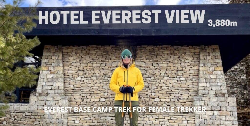
For those seeking opulence amidst the mountains, Hotel Everest View is a posh hotel that offers exquisite Japanese food along with a wide variety of other cuisines. You can schedule an overnight journey to Mount Everest.
Why Visit Everest From Nepal?
Firstly, securing a climbing permit from Tibet proves extremely challenging, and one can reach the base camp only by road, offering an incredible experience. Trekking routes offer stunning views of the diverse climate, stunning terrain, and exquisite culture of Nepal’s southern region.
The incredible journey of trekking to the Everest region begins on the first day of the program. The amazing journey to Lukla, a notoriously perilous airport, and retracing Tenzing and Hillary’s route. Also referred to as the Tenzing Hillary Route or the traditional Everest base camp route. The trail includes breathtaking peaks, glaciers, waterfalls, and a variety of scenery.
Local Culture in the Everest Region
Taking in the local culture while strolling or trekking the trail. Getting a closer look at the Sherpa way of life will astound tourists with every step they take on the paths. Among many other items, there are the prayer wheels, Chortens, Mani walls, and flags that wave in prayer.
In contrast to other regions of the world, the stunning town of Namche, the monasteries at Tengboche, the monastery festival, and the Everest from Nepal occur uniquely. It might be magic, but there is something in the air on Mount Everest that only those who visit can truly comprehend. You can read books, hear stories, and see images, but you cannot truly experience the beauty that the Everest region possesses unless you are physically there.
The best thing is that the Everest region is safer than the north since the south has helicopter rescue facilities in case of emergency, difficulties, or other threats that may arise throughout the trip and ascent.
Everest’s climate is hostile to all living things. January has the coldest average temperature of -36 degrees Celsius, while the highest average daytime temperature is approximately -19 degrees Celsius. There are occasions when the mercury falls as low as -60 degrees Celsius. Avalanches constantly put climbers’ safety in danger, and storms might develop out of nowhere. Climbers of Everest face a very high risk of frostbite.
Sagarmatha National Park

The Everest region is home to a wide range of animals and plants. The area has been turned into national parks for Makalu Barun and Sagarmatha. Numerous endangered birds, including the red panda, snow leopard, and Himalayan monal (Lophophorus impejanus), can be found in this area. The details of Yeti’s tale are still unknown, though.
Many people thought that yetis were man-eaters; some people think they still exist, while others think they are extinct. Some people think that people who experience altitude sickness can imagine random images and mistake them for Yetis. The yeti’s scalp, which has multiple scientific explanations for both its existence and non-existence, is kept in the monastery in Khumjung village.
Avalanches
The Khumbu Glacier is an avalanche-risk area. The glacier is situated on the level plain of the mountain under the neighboring peaks of Kalapatthar, Pumori, and Lingtren. Location of the helicopter landing and the popular walk to Kalapatthar, followed by the helicopter return.
Every year, 40,000 climbers and hikers visit the pop-up tented camps, followed by senior support climbers, porters, guides, and a select group of people. Numerous glaciers and sheer ice falls can be found on Everest and the neighboring peaks. The icefall dangles down the mountainside like frozen cascades. Massive snow hills known as avalanche cones are indicative of avalanches.
Different Names of Mount Everest
The names of Mount Everest, which is also referred to as “Sagarmatha” in Nepal and “Chomolungma” in Tibet, are a rich tapestry that reflects the region’s cultural and historical diversity.
Even the term “Everest” itself has British colonial origins. The Great Trigonometric Survey of India, headed by Sir George Everest, was instrumental in measuring and charting the Himalayas in the middle of the 19th century. The peak bears Everest’s name in honor of his contribution.
Before becoming widely recognized as the highest point on Earth, Mount Everest was known by a different, but less well-known, name: “Peak XV.” Included in the previously stated Great Trigonometric Survey of India, which Sir George Everest oversaw in the middle of the 19th century, was this appellation. Peak XV was designated according to the survey’s numerical order.
The Nepali name for this towering colossus, “Sagarmatha,” means “Forehead in the Sky,” perfectly expressing the veneration and awe felt by the people. The name Sagarmatha, which embodies the mountain’s spiritual and cultural significance, was suggested by historian Baburam Acharya.
Using indigenous names for geographical sites, the Government of Nepal (then known as His Majesty’s Government) formally adopted this name in the 1960s, marking a concerted attempt to recover and underline the nation’s cultural identity. The Tibetan name “Chomolungma” translates to “Goddess Mother of Mountains,” highlighting the peak’s special spiritual significance for the people of Tibet.
“Qomolangma” is another spelling that is frequently used. The disparities in transliteration systems and the subtleties involved in utilizing the Roman alphabet to represent Tibetan sounds account for the spelling variances. An understanding of the varied nomenclature enhances the mountain’s essence, blending scientific inquiry with cultural awe.
Where to stay while traveling to Mount Everest?
When visiting the Himalayas around Mount Everest, there are many lodges to stay in. From modest private lodgings to opulent lodge rooms, you can select lodging based on your preferences and financial constraints.
Every hotel you spend the night in has a menu for meals, and you also get one at each of the trek’s lunch breaks. Instead of having to wait for the regional cuisine, you can select meals from the menu. You can also get local dishes if you’d like to taste them. It implies that if you are traveling to the Everest Region, you do not need to pack food and tents.
In addition to the lodging and cuisine, practically everywhere has cell phone reception, including the base camp on the Everest Base Camp Trek and other routes. With a WiFi top-up card from the Everest Link and cell phone data, you may access the internet. There are also battery charging stations and hot baths available. Even so, it’s more economical to bring a power bank or solar charger.
The Height of Mount Everest
With its breathtaking height, Mount Everest, the gem in the Himalayas, has long captured the attention of people. Everest’s elevation was reassessed after it was first recorded at 29,032ft (8,848.86 meters) above sea level due to developments in technology.
Slightly beneath the preceding size, a Chinese survey team measured the elevation in 2005 at 29,017 feet (8,844 meters). But the biggest alternative came about in 2020 whilst China and Nepal collectively declared a revised elevation of 29,032ft (8,848.86 meters).
This modification, which accounts for the snow and ice covering the pinnacle, represents the teamwork involved in producing the most accurate portrayal of Everest’s size.
Mountain Peaks Surrounding Everest
Surrounding Mount Everest in the Himalayan range are several daunting peaks in equally stunning surroundings. Lhotse, the world’s fourth-tallest peak, lies to the south of Everest, connected by the South Col.
Part of the Everest Massif, the ambitious Makalu towers to the southeast. When we turn to the west, the imposing Cho Oyu—the world’s 6th-highest mountain—graces the horizon.
These surrounding giants, collectively known as the Everest Massif, largely contribute to the breathtaking scene that greets climbers on their challenging journey to Everest’s summit.
Different Climbing Routes on Mount Everest
Climbers face many barriers and demanding situations when trying to reach the summit of Mount Everest, and each route has its unique rewards and demanding situations. The North Col Route, which is approached from Tibet, and the South Col Route, which is accessed from Nepal, are the 2 primary routes.
South Col Route
Climbers start in Nepal, navigating the Khumbu Icefall, Western Cwm, and Lhotse Face to summit Everest via the Southeast Ridge from the South Col, with the renowned Base Camp on the Nepalese side, making it the favored route.
Everest South Col Route Itinerary
Days 1-2: Arrival in Kathmandu
Day 3: Kathmandu to Lukla and Trek to Phakding
Day 4: Phakding to Namche Bazaar
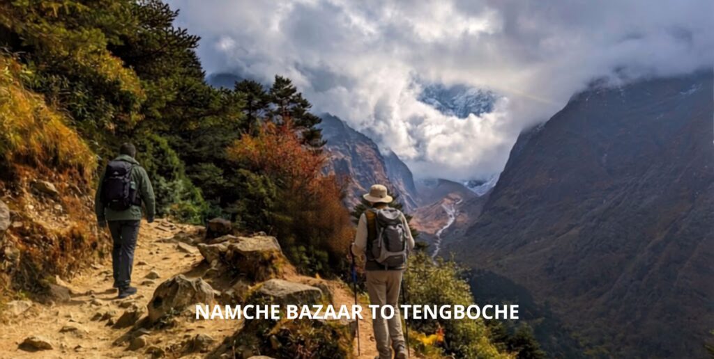
Day 5: Namche Bazaar to Tengboche
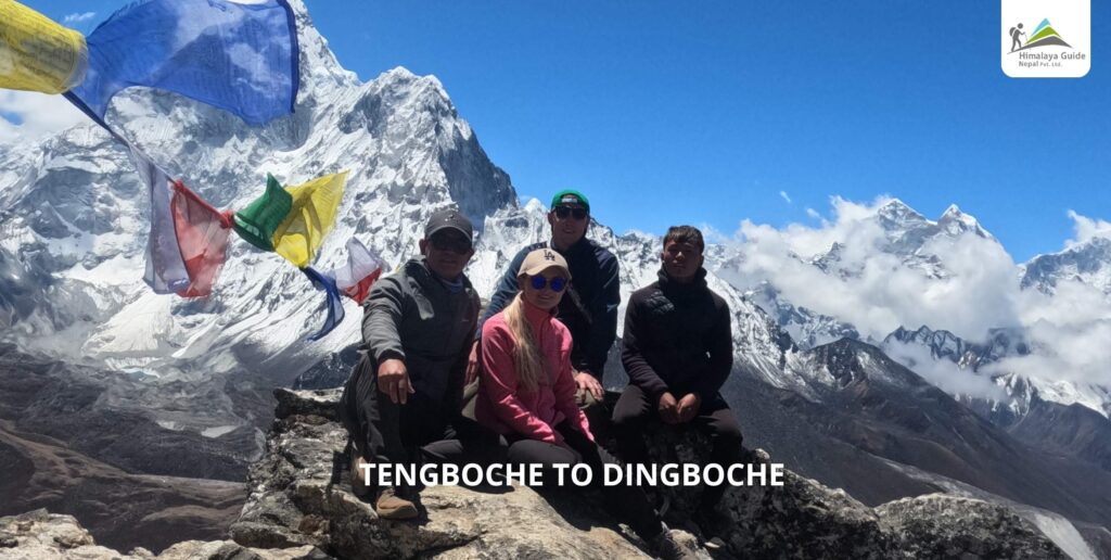
Day 6: Tengboche to Dingboche
Day 7: Acclimatization Day in Dingboche
Day 8: Dingboche to Lobuche
Day 9: Lobuche to Gorak Shep and Everest Base Camp
Day 10: Gorak Shep to Kala Patthar and Descend to Pheriche
Day 11: Pheriche to Namche Bazaar
Day 12: Namche Bazaar to Lukla
Day 13: Fly from Lukla to Kathmandu
Day 14: Departure from Kathmandu
North Col Route
To attain the Tibetan side, one should traverse the Rongbuk Glacier, make their way through the North Col, and then climb the North Face. After that, climbers tour across the Northeast Ridge to the summit. The North Col Route provides a distinct viewpoint and assortment of difficulties in contrast to its southern counterpart.
Everest North Col Route Itinerary
Days 1- 2: Arrival in Kathmandu.
Day 3: Fly to Lhasa (3,650 meters)
Day 4: Acclimatization Day in Lhasa
Day 5: Drive to Shigatse (3,900 meters)
Day 6: Drive to Shegar (New Tingri)
Day 7: Acclimatization Day in Shegar
Day 8: Drive to Everest Base Camp (5,200 meters)
Days 9-10: Trek to Intermediate Camp (5,800 meters)
Day 11: Trek to North Col (7,000 meters)
Day 12: Descent to Everest Base Camp
Day 13: Drive back to Shigatse
Day 14: Drive to Lhasa
Day 15: Fly from Lhasa to Kathmandu
Day 16: Departure from Kathmandu
Flora and Fauna of the Everest Region
In addition to being a refuge for mountaineers, the Everest region is home to a wide variety of plant life and animals that have adapted to the harsh conditions of this high-altitude habitat. Climbers revel in a terrific alternative in the scenery as they circulate through the one-of-a-kind organic zones.
The People of the Everest Region
The vibrant tapestry of the Everest region intertwines with the rich cultural strands of its people, notably the Sherpa, renowned for fortitude, tenacity, and mountaineering skills, profoundly shaping Everest’s history and legends.
These mountainous tribes have cultivated a symbiotic relationship with the lofty peaks thanks to their customs and traditions. Particularly, the Sherpas are vital to climbing expeditions that aim to reach the summit of Everest as guides, porters, and helpers. The Everest story is further enhanced by their enduring bond with the region and its spiritual importance.
Conclusion
In conclusion, standing virtually atop Everest emphasizes that ascending involves more than physical effort; it’s exploring nature, history, and preserving the environment.
FAQs About Mount Everest
Where is Mount Everest located?
In which country is Mount Everest located?
What is the exact elevation of Mount Everest?
What is the significance of Mount Everest’s location?
How do I reach Mount Everest Base Camp?
Are there alternative routes to reach Mount Everest?
What is the climate like around Mount Everest?
How is Mount Everest visible from space?